
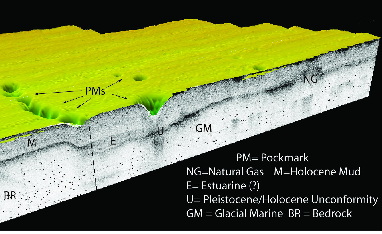
3-D view of a seismic profile
Detailed Description
3D view of a seismic profile draped under bathymetry. Browse graphic for U.S. Geological Survey ScienceBase data release, High-resolution geophysical data collected in the Belfast Bay, Maine pockmark field in 2006, 2008, and 2009 by the U.S. Geological Survey
Sources/Usage
Public Domain.