
Automated waterline mapping using deep learning
Detailed Description
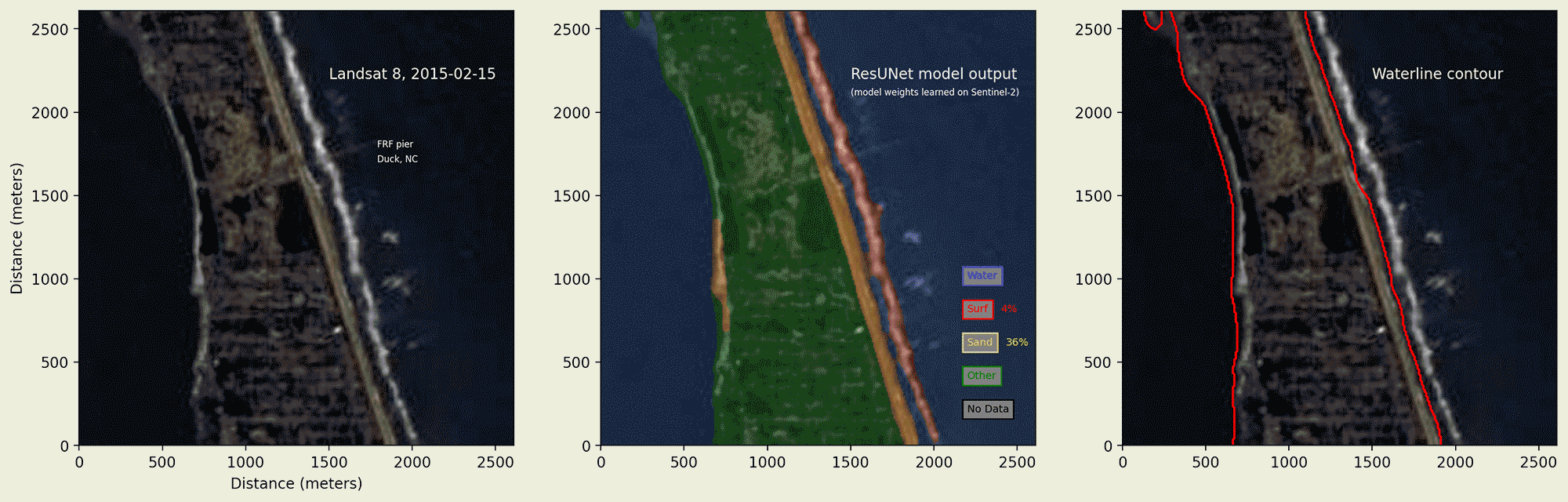
A figure demonstrating automated waterline mapping using deep learning. The left panel shows a time-series of Landsat-8 imagery near Duck, North Carolina, in the vicinity of the USACE Field Research Facility pier (marked on the image). Imagery spans the period 02/15/2015 to 09/11/2021 The middle panel shows output from a 4-part image segmentation model trained to recognize the following categories:
a) water,
b) surf (whitewater / broken waves),
c) sand, and
d) other.
Proportions of sand and surf pixels are enumerated and shown. The left panel shows the waterline contour, extracted automatically from the image segmentation results.
Sources/Usage
Public Domain.