
Blue-winged Teal Migration Data
Detailed Description
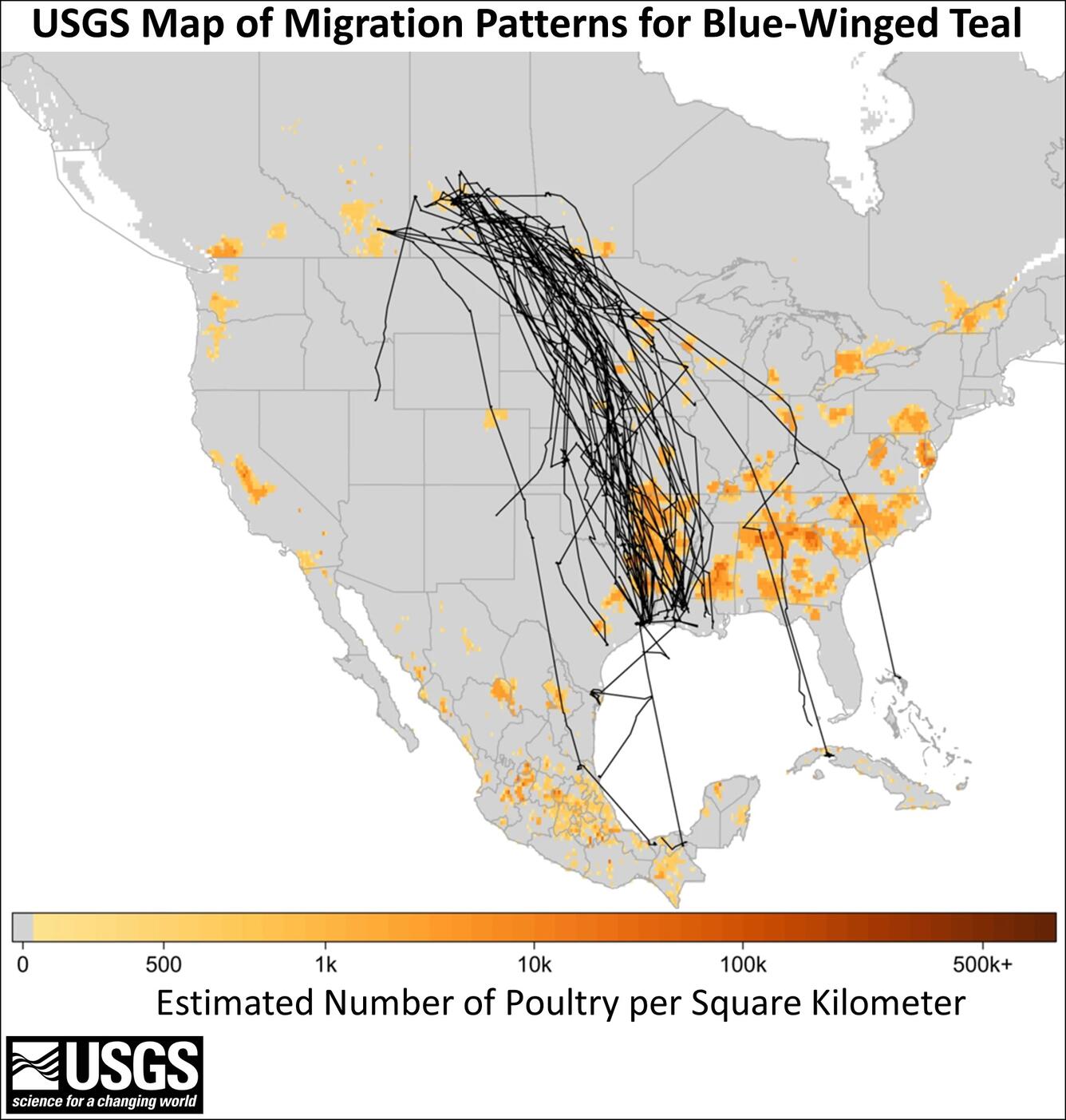
USGS map showing blue-winged teal’s migratory movements and proximity to poultry facilities. Black lines show individual bird tracks, and the legend describes estimated number of poultry (chickens and turkeys) per square kilometer. To better display poultry abundance in this figure, zero was defined as less than 100 poultry per square kilometer.
Sources/Usage
Public Domain.