
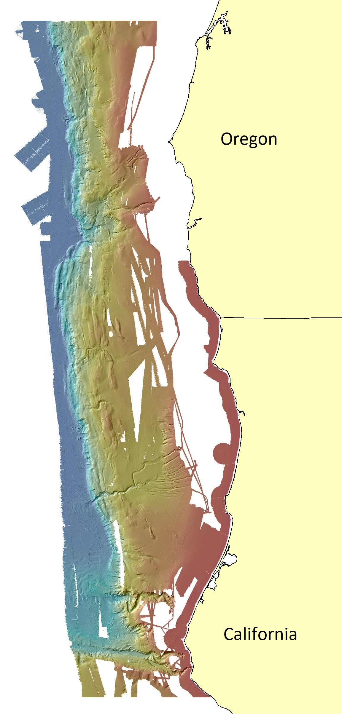
Cascadia margin bathymetry
Detailed Description
Bathymetry data from various sources, including newly released 2018 and 2019 multibeam data collected by the National Oceanic and Atmospheric Administration (NOAA) and the U.S. Geological Survey (USGS), were combined to create a composite 30-m resolution multibeam bathymetry surface of the southern Cascadia Margin offshore of Oregon and northern California.
Sources/Usage
Public Domain.
USGS data release
Composite multibeam bathymetry surface and data sources of the southern Cascadia Margin offshore Oregon and northern California, by Dartnell, P., Conrad, J.E., Watt, J.T., and Hill, J.C., published 8/23/21.