
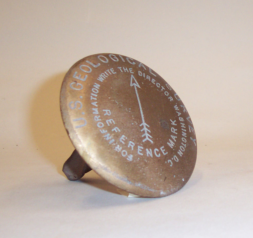
Cast Bronze Benchmark

Detailed Description
Benchmarks can be divided into two general groups: the "vertical control points" are points that mark a very precise elevation above the standard datum plane (usually referred to as elevation above sea level) and the "horizontal control points" are points with precisely established latitude and longitude. The National Geodetic Survey, not the U.S. Geological Survey, is the Maintainer of federal Vertical Control Marks. This specimen is a Reference Benchmark and not a geodetic control mark. In actual use, this marker would have been used to keep the location of a triangulation station from being lost. Its arrow would be set to the location of the triangulation station; the station's description would have accurate azimuth and horizontal (not slope) distance to each of its reference marks so that it can be re-set from them if necessary.
Object ID: USGS-000181
Sources/Usage
Public Domain.