
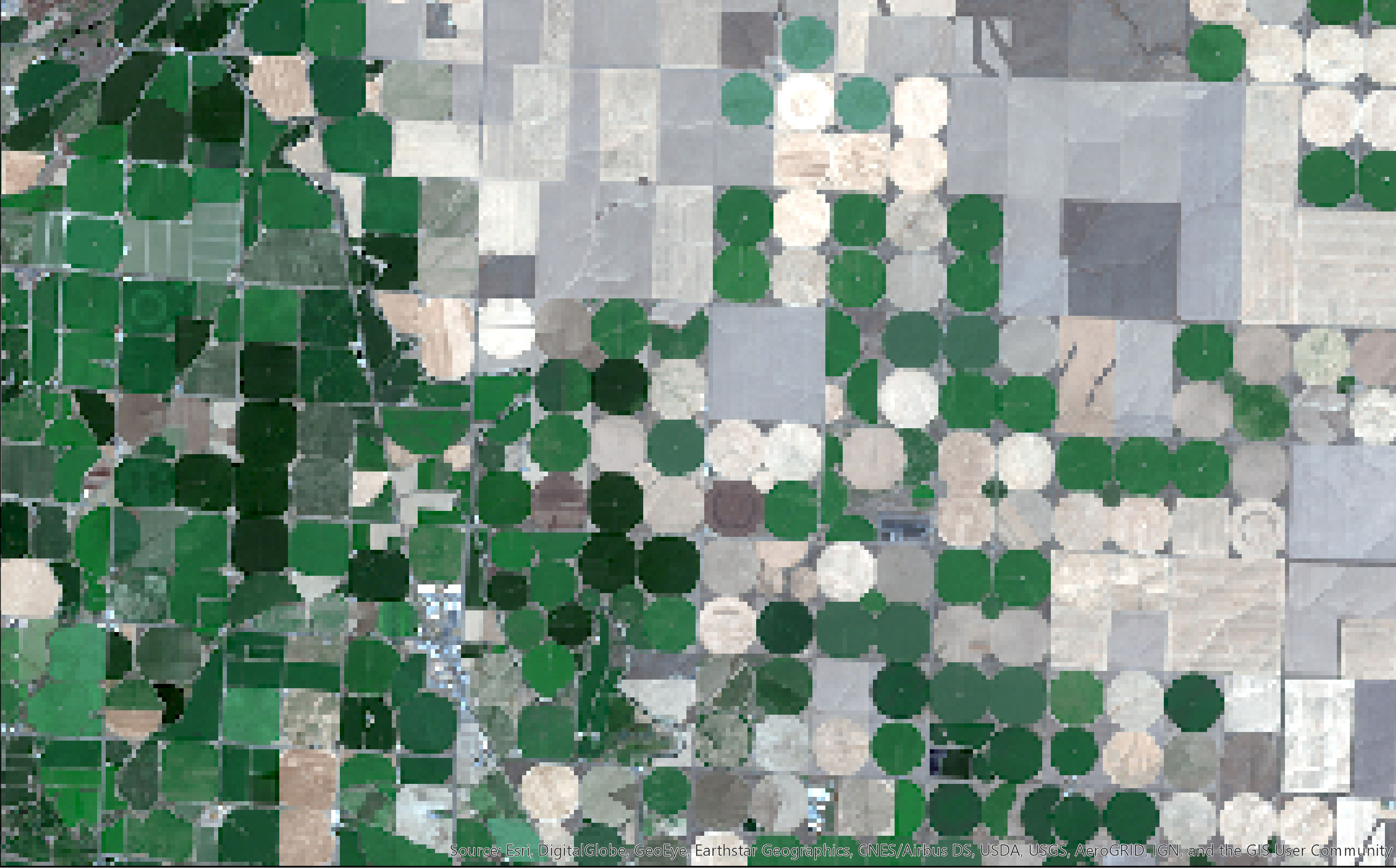
Center Pivot Irrigation (Natural Color) - Landsat 8

Detailed Description
Have you looked at images like these and wondered what the circles are? In this case, they are the irrigated lands of southwest Washington state. These kinds circular structure are formed through “center pivot irrigation,” which involves equipment rotating around a pivot to water crops with sprinklers. Since the water sprinkles in a circular fashion, this creates circular patterns in crops when viewed from above.
Center pivot irrigation has lower labor costs and helps reduce water runoff and soil erosion. These wonderful circular patterns can be viewed from above though satellite images.
The data used to build these images were captured by Landsat 8 on August 13, 2019, then downloaded and processed in ArcGIS on August 20, 2019. Landsat 8 is the most recent satellite in the Landsat program (Landsat 9 will launch in December 2020). Landsat 8 has provided some truly stunning images of the Earth’s surface since its launch on February 11, 2013.
The Operational Land Imager (OLI) onboard Landsat 8 has nine bands that capture the spectral response at 30-meter resolution. Additionally, the satellite’s Thermal Infrared Sensor (TIRS) sensor collects information at two discrete wavelengths within the thermal infrared portion of the electromagnetic spectrum at 100-meter resolution. These wavelengths combine at specific range to form bands.
The 11 bands of Landsat 8 can be combined in different ways to produce unique maps. This image uses bands 4, 3, and 2 to produce a natural color image.
Sources/Usage
Public Domain.
Related

Verification Datasets of Irrigation Status of Agricultural Lands in Select Areas of Montana, 2019 and 2020
Related