
Cloud free map composites of the confluence of the Sacramento and San Joaquin Rivers
By Western Geographic Science Center
January 2023 (approx.)

Detailed Description
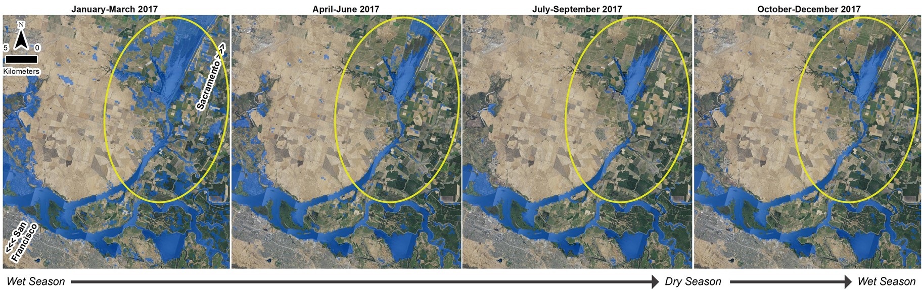
Dense stacks of images to create cloud-free map composites. In this case at the confluence of the Sacramento River and San Joaquin River in California, cloud-free composites include winter inundation and allow the team to measure seasonal surface water variability. The yellow circle highlights where surface water varies the most over the time series.
Sources/Usage
Public Domain.
Related

Patterns in the Landscape – Analyses of Cause and Effect
Understanding the rates and causes of land-use/land-cover (LULC) change helps answer questions about what, where, how, and why the Earth’s surface is changing. Land-surface change results from human activities or natural processes like floods, droughts, and wildfires, and many of these change processes are observable in satellite imagery. The growing historical catalog of satellite images allows...
Related
Patterns in the Landscape – Analyses of Cause and Effect
Understanding the rates and causes of land-use/land-cover (LULC) change helps answer questions about what, where, how, and why the Earth’s surface is changing. Land-surface change results from human activities or natural processes like floods, droughts, and wildfires, and many of these change processes are observable in satellite imagery. The growing historical catalog of satellite images allows...