



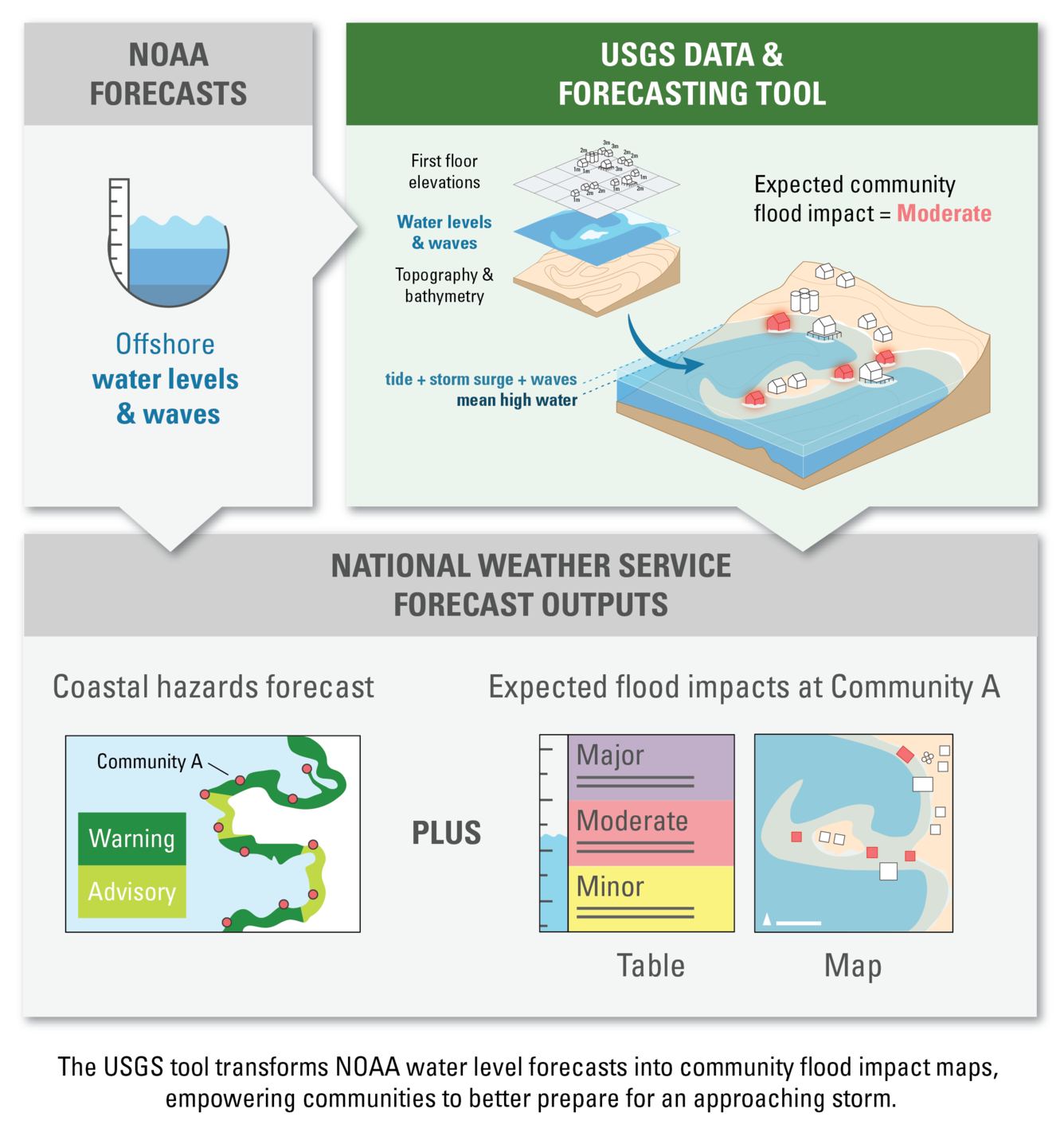
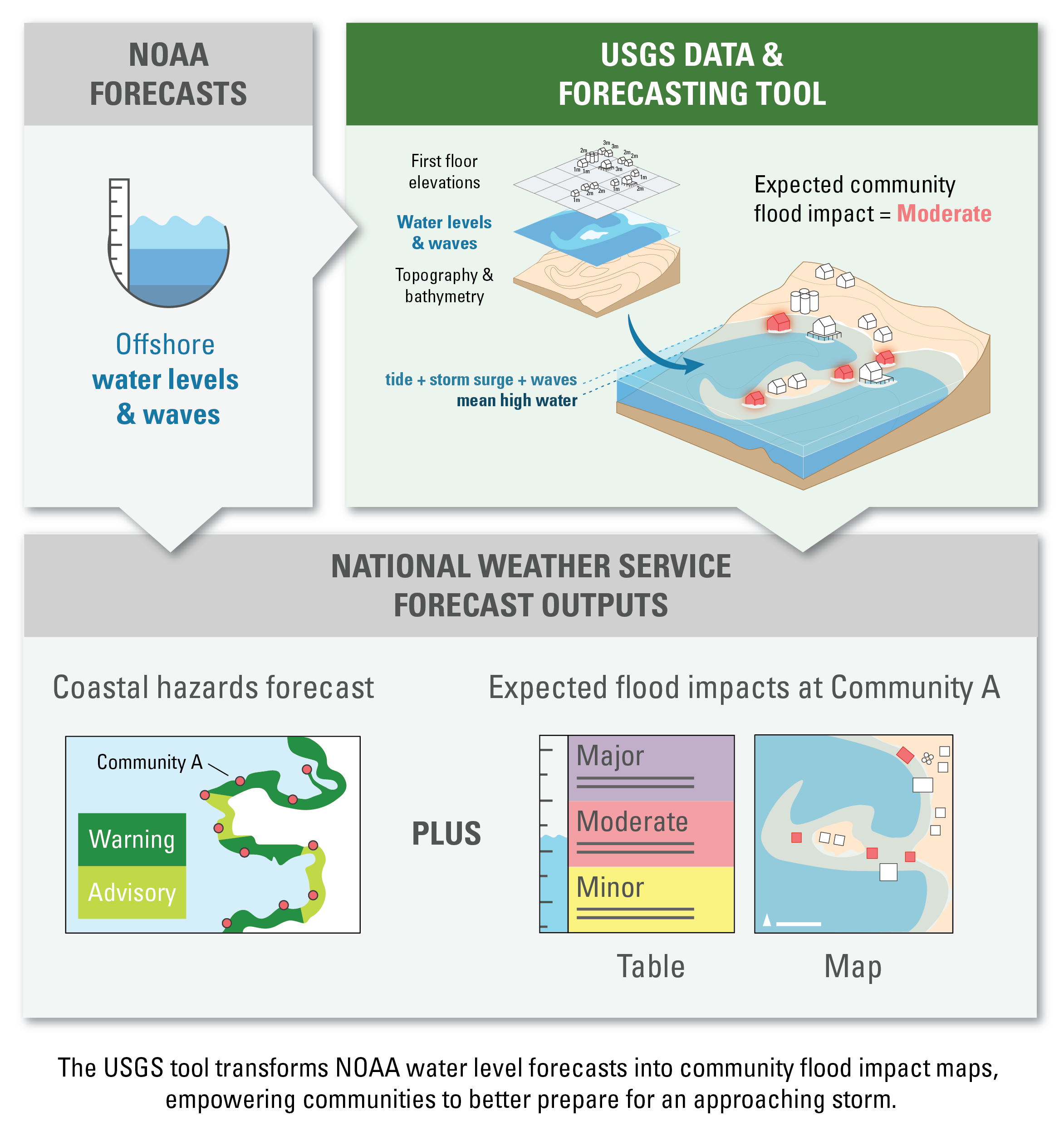
Coastal hazard forecasting flowchart


Detailed Description
Flowchart showing how USGS data and tools enhance National Weather Service coastal hazards forecasts by transforming NOAA water level and wave predictions into detailed tables and maps of expected coastal flooding impacts for communities.
Sources/Usage
Public Domain.
Related
Typhoon Merbok Disaster Recovery Project: Accomplishments
The Typhoon Merbok Disaster Emergency Recovery Efforts project addresses critical data and capacity gaps in coastal Alaska by generating high resolution environmental datasets, hazard analyses, and monitoring tools needed to quantify erosion, flooding, and permafrost-related risks at the community scale.
Related
Typhoon Merbok Disaster Recovery Project: Accomplishments
The Typhoon Merbok Disaster Emergency Recovery Efforts project addresses critical data and capacity gaps in coastal Alaska by generating high resolution environmental datasets, hazard analyses, and monitoring tools needed to quantify erosion, flooding, and permafrost-related risks at the community scale.