
CoSMoS Interactive Mapper in Pacifica
Detailed Description
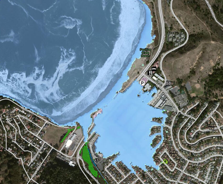
Projections of future coastal flooding by CoSMoS indicate that the city of Pacifica is among the most vulnerable cities to climate change on the entire outer coast of California. This map from Our Coast, Our Future shows the projected future flooding at Pacifica considering 1.25 m of sea level rise with the added impacts of an extreme storm.
Sources/Usage
Public Domain.
Our Coast, Our Future
Our Coast, Our Future (OCOF) is a collaborative, user-driven project focused on providing coastal California resource managers and land use planners locally relevant, online maps and tools to help understand, visualize, and anticipate vulnerabilities to sea level rise and storms.
Related

The Coastal Storm Modeling System
The Coastal Storm Modeling System (CoSMoS) provides emergency responders and coastal planners with critical storm-hazard information such as flood extent, flood depth, duration of flooding, wave height, and currents that can be used to increase public safety, mitigate physical damages, and more effectively manage complex coastal settings. The CMHRP initially developed CoSMoS in collaboration with...
Related
The Coastal Storm Modeling System
The Coastal Storm Modeling System (CoSMoS) provides emergency responders and coastal planners with critical storm-hazard information such as flood extent, flood depth, duration of flooding, wave height, and currents that can be used to increase public safety, mitigate physical damages, and more effectively manage complex coastal settings. The CMHRP initially developed CoSMoS in collaboration with...