
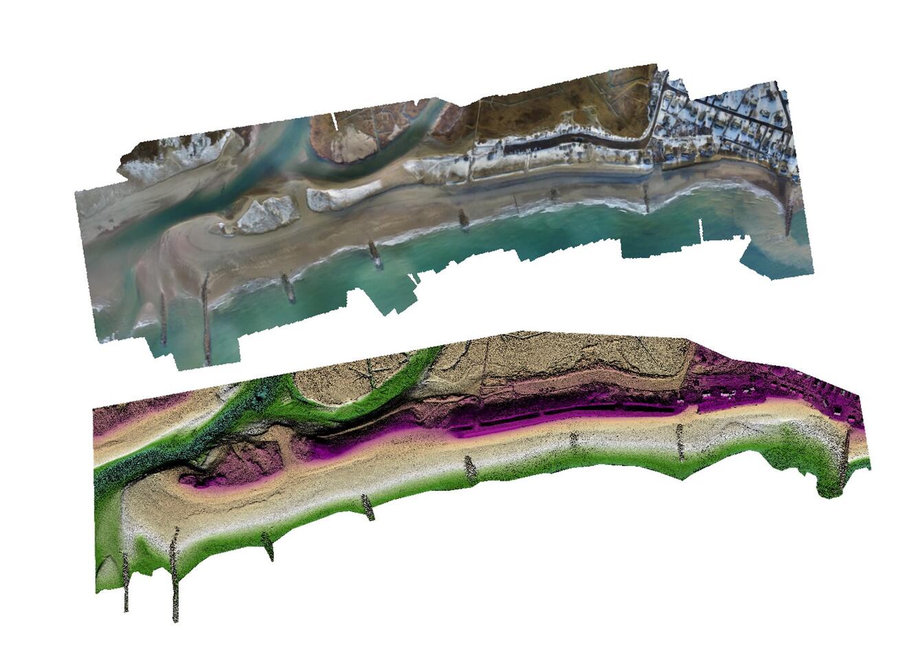
Digital Elevation Model and Orthomosaic, Sandwich, MA
Detailed Description
Examples of a digital elevation model and orthomosaic from Town Neck Beach, Sandwich, MA used for a browse graphic for Structure from motion products associated with UAS flights in Sandwich, Massachusetts between January 2016 - September 2017, U.S. Geological Survey ScienceBase data release.
Sources/Usage
Public Domain.