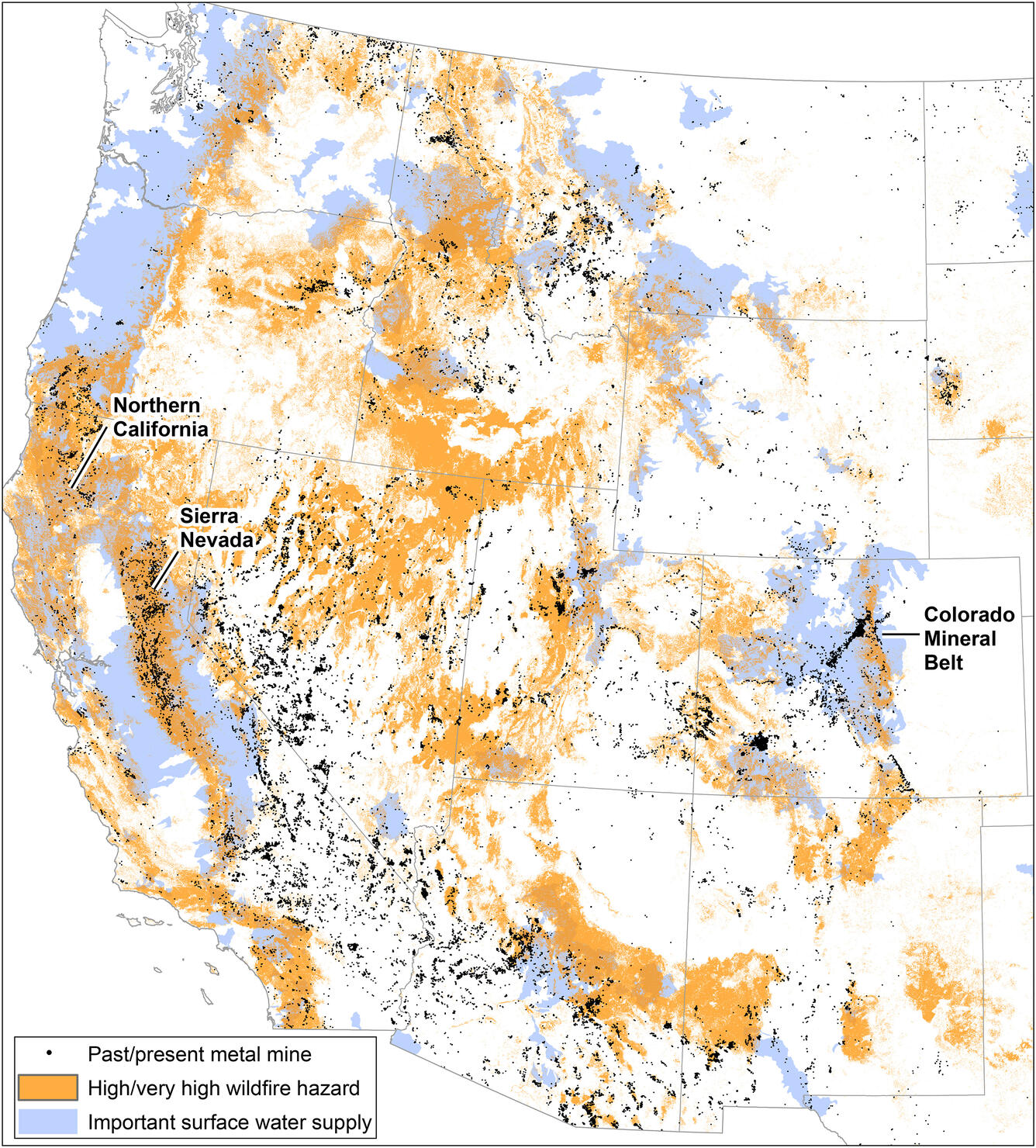
Drinking Water Watersheds and Risks across the Western U.S.

Detailed Description
Map of western U.S. showing mines, wildfire potential, and important surface water supply watersheds. Many watersheds in the west that supply drinking water contain historical mines, and are also at risk from wildfires. Credit: Sheila Murphy, USGS, from Figure 8 in Murphy et al. (2020).
Sources/Usage
Public Domain.

