



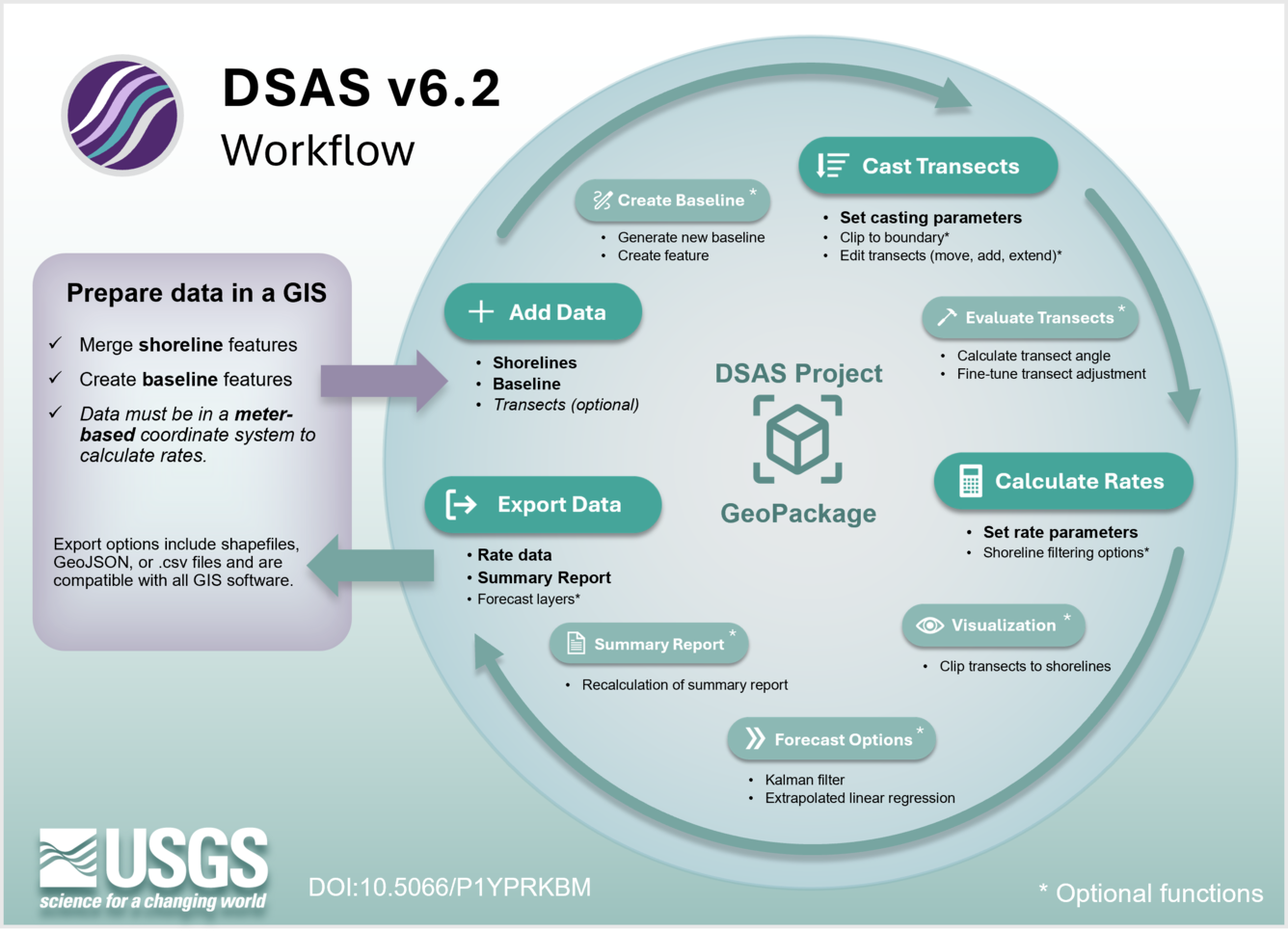
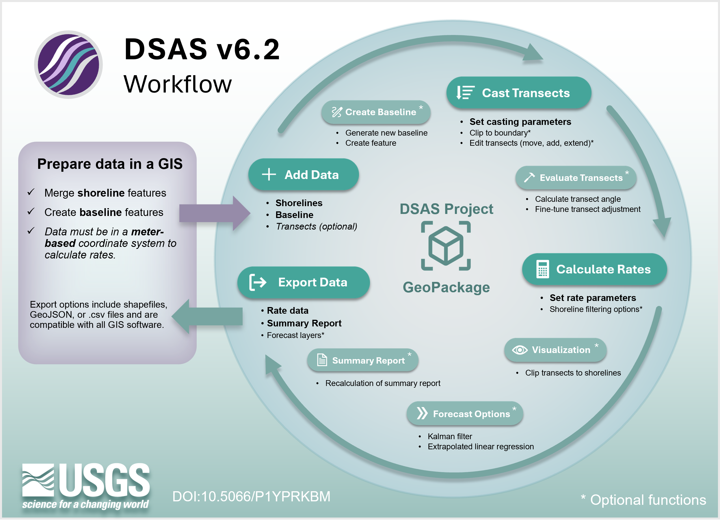
DSAS v6.2 workflow


Detailed Description
DSAS version 6.2 combines all prior functionality including: regression metrics and distance measurements; FDGC-consistent metadata; a summary report; shoreline forecasting; the application of the proxy-datum bias; data editing options; and enhanced data visualization options. In addition, features NEW to DSAS include: a tool for baseline creation; the option to clip transects to an imported feature; the visualization of shorelines by date; a tool to calculate and record the average angle of the shorelines to the transect, with an advanced option to automatically adjust the transect angle; options to filter rate calculation by subsampling shorelines (using date range, month, or other feature attributes), and the per-transect visualization of shoreline positions through time. These advancements make DSAS a powerful boundary change tool with broad applications for research, while also improving accessibility and flexibility for a wide range of projects and users.
Sources/Usage
Public Domain.
Related

Digital Shoreline Analysis System (DSAS)
Related