
DUNEX Pea Island Experiment

Detailed Description
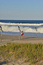
The USGS, including scientists from the Woods Hole Coastal and Marine Science Center, participated in the multiagency DUNEX (During Nearshore Event Experiment) project in the Outer Banks of North Carolina, September through October 2021. Maps of the beach were made at regular intervals. A weather station measured metrological data, offshore instruments measured waves, water levels, and currents, and CoastCams recorded wave runup and changes in beach morphology. The team began processing all these extensive datasets and published two.
Sources/Usage
Public Domain.