
Elevation difference maps of Assateague Island, Maryland
Detailed Description
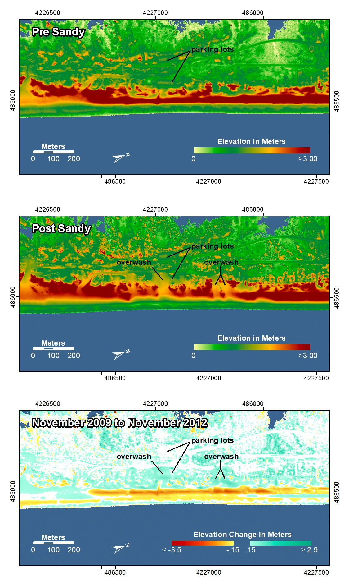
Assateague Island, Maryland. The dunes along this stretch of island were constructed to protect the road and other infrastructure. They were relatively high, wide, and extended uniformly along the beach. After Hurricane Sandy the dunes were eroded in several places and overwash deposited sand on the landward side of the dune line and in the seaward-most parking lot.
In the pre- and post-storm elevation maps, orange and red colors indicate higher elevations while yellow and green colors indicate lower elevations. In the elevation difference maps, red colors indicate erosion such as shoreline retreat, and blue-green colors indicate accretion, such as overwash deposits where waves and surge have moved sand landward. Maps are oriented with the Atlantic Ocean on the bottom.