
Epicenter maps of Tonga Trench earthquake
Detailed Description
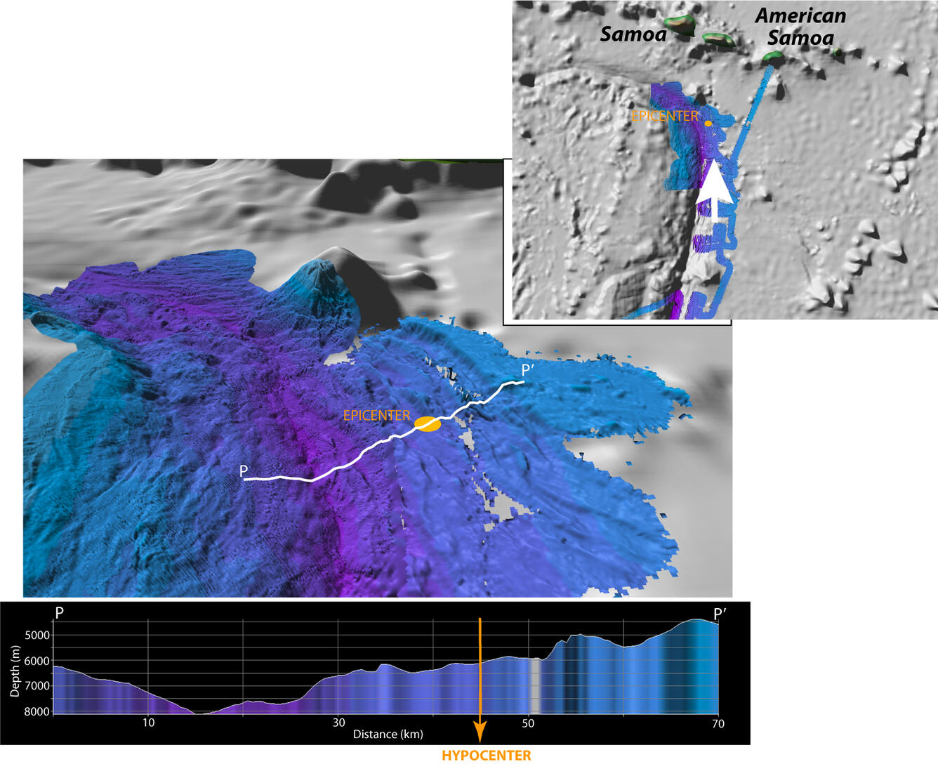
Map and perspective view of the Tonga Trench near the earthquake epicenter. Shaded relief bathymetry generated from multibeam data available from the National Geophysical Data Center (NGDC) (Survey KIWI11RR, Chief Scientist Nancy Kanjorski, see the multibeam report) and Oregon State University (courtesy Professor Dawn Wright), along with ETOPO-1 bathymetry data (view the ETOPO-1 data sources). The vertical exaggeration of the perspective view is 4x. Approximate location of epicenter (surface projection of earthquake’s origin) shown by orange circle.
Sources/Usage
Public Domain.
Related

Preliminary Analysis of the 2009 Samoa Tsunami
The tsunami that was triggered by a magnitude 8.1 earthquake on September 29, 2009, caused significant damage and loss of life on Samoa, American Samoa, and Tonga. In the hopes that disasters such as this can be minimized in the future, we attempt to understand the mechanism and impact of this tsunami. The information presented here is focused on geologic aspects of the disaster.
Related
Preliminary Analysis of the 2009 Samoa Tsunami
The tsunami that was triggered by a magnitude 8.1 earthquake on September 29, 2009, caused significant damage and loss of life on Samoa, American Samoa, and Tonga. In the hopes that disasters such as this can be minimized in the future, we attempt to understand the mechanism and impact of this tsunami. The information presented here is focused on geologic aspects of the disaster.