
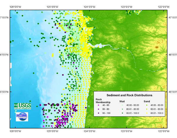
Example of usSEABED offshore mud, sand, and rock distributions
Detailed Description
Maps produced from the usSEABED database, such as this example showing mud, sand, and rock distributions, can be used in a variety of ways such as finding the location of mud belts and rocky areas for habitat analysis.
Sources/Usage
Public Domain.