
February 22, 2021 — Kīlauea
By Kīlauea
Detailed Description
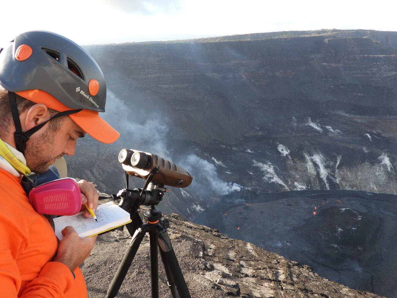
An HVO geologist uses a sketch in their fieldbook to note the location of laser rangefinder measurements of the lava lake in Halema‘uma‘u crater, at the summit of Kīlauea. Using the laser rangefinder, HVO geologists can derive the elevation of various spots on the lava lake surface, and are able to track how the elevation of features within the lava lake change over time. Field measurements on February 22 indicated that the lava in the western (active) portion of the lake in Halema‘uma‘u has filled 216 m (712 ft) of the crater. USGS photo by M. Patrick.
Sources/Usage
Public Domain.