An official website of the United States government
Here's how you know
Official websites use .gov
A .gov website belongs to an official government organization in the United States.
Secure .gov websites use HTTPS
A lock () or https:// means you’ve safely connected to the .gov website. Share sensitive information only on official, secure websites.
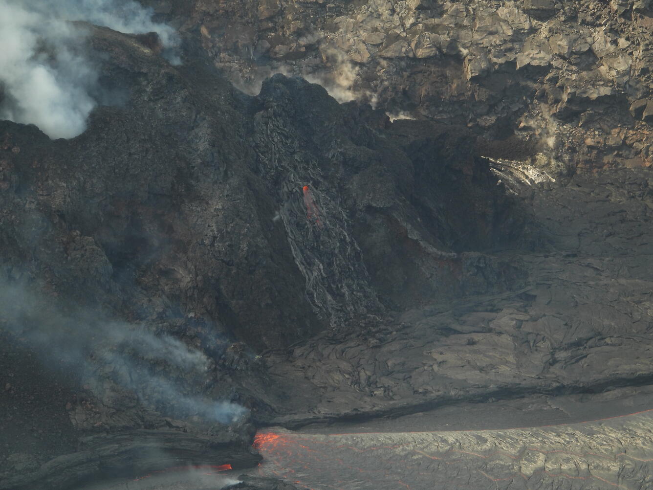
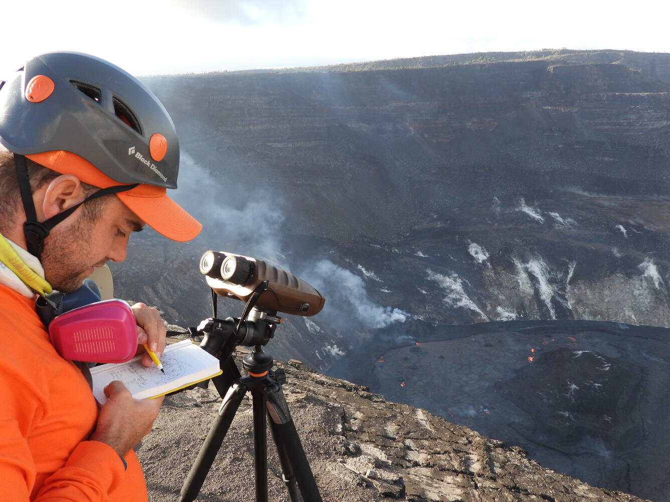
Kīlauea's summit eruption continues on the Island of Hawai‘i; the west vent in Halema‘uma‘u erupts lava into the lava lake. Gas emissions and seismic activity at the summit remain elevated. HVO field crews—equipped with specialized safety gear and PPE—monitor the current eruption from within the closed area of Hawai&lsq
HVO scientists collect detailed data to assess hazards and understand how the eruption is evolving at Kīlauea's summit, all of which are shared with the National Park Service and emergency managers. Access to this hazardous area is by permission from, and in coordination with, Hawai‘i Volcanoes National Park.
Sources/Usage: Public Domain.
The lava lake in Halema‘uma‘u crater, at the summit of Kīlauea, remains active. Active surface lava remains limited to the western portion of the lake, shown here. Ongoing summit deflation has been associated with a slight drop in the lake level, now a few meters below the rim of the levee. The western fissure cone is in the upper left corner of the photo, and inlet where lava enters the lake is the incandescent zone just above and left of center. USGS photo by M. Patrick.
Sources/Usage: Public Domain.
This photo shows the main island, just west of the lake center, in Halema‘uma‘u lava lake at the summit of Kīlauea. The recent drop in lake level, associated with ongoing summit deflation, is shown by the raised edge around much of the perimeter of the island. USGS photo by M. Patrick.
Sources/Usage: Public Domain.
This photo shows a view of the western fissure, feeding the lava lake in Halema‘uma‘u at the summit of Kīlauea. The inlet zone, where lava is entering the lake, is visible at the bottom of the photo. Near the center of the photo, an area of lava driblets can be seen running down the flank of the western fissure's cone. USGS photo by M. Patrick.
Sources/Usage: Public Domain.
An HVO geologist uses a sketch in their fieldbook to note the location of laser rangefinder measurements of the lava lake in Halema‘uma‘u crater, at the summit of Kīlauea. Using the laser rangefinder, HVO geologists can derive the elevation of various spots on the lava lake surface, and are able to track how the elevation of features within the lava lake change over time. Field measurements on February 22 indicated that the lava in the western (active) portion of the lake in Halema‘uma‘u has filled 216 m (712 ft) of the crater. USGS photo by M. Patrick.
Sources/Usage: Public Domain.
A pot of lava at the end of the rainbow? A rainbow formed over Halema‘uma‘u crater following an afternoon rain shower on February 22. Rainbows are often observed over Halema‘uma‘u, as mist and rain move across the caldera. This photo was taken from within an area of Hawai‘i Volcanoes National Park that remains closed to the public for safety reasons. HVO scientists continue to monitor the eruption from within this closed area with permission from Hawai‘i Volcanoes National Park.