
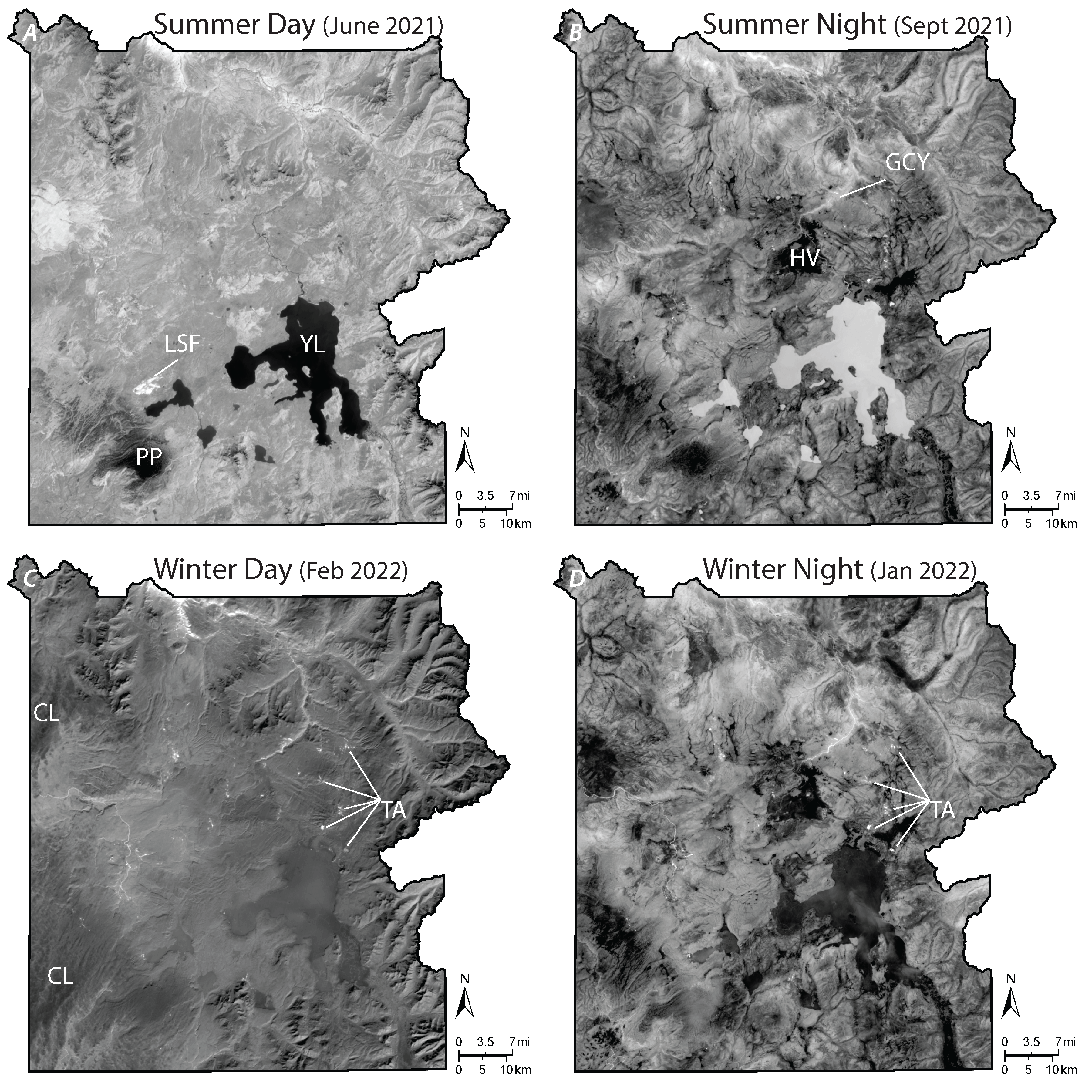
Landsat 8 thermal infrared images of Yellowstone showing daily and seasonal differences.

Detailed Description
Landsat 8 thermal infrared images of Yellowstone showing daily and seasonal differences. In these greyscale images, bright pixels are warmer and dark pixels are cooler. In the daytime images (A and C), you can see the effects of topography, with darker (cooler) pixels like shadows on north-facing slopes and brighter (warmer) pixels on sun-facing slopes. Comparing summer day vs. night images (A and B), you can see the effects of differences in thermal properties of different materials, as water bodies like Yellowstone Lake (YL) are warmer at night and cooler during the day compared to surrounding land. Also, note the snow-covered Pitchstone Plateau (PP); and the cold open area of Hayden Valley (HV) compared to surrounding densely forested areas that are warmer. In the winter (C and D), most lakes are frozen, thus colder. You can also see the distinctive texture of clouds (CL) in the image from Feb 2022. Clouds would look bright white to our eyes, but in the thermal infrared they are dark because they are cold. In all the images you can see that at lower elevations, such as along the Grand Canyon of the Yellowstone (GCY), the surface is generally warmer. In the image from June 2021, you can see the burn scar from the Lone Star Fire (LSF), which burned from Aug-Sept 2020. After the heat from the fire is gone, the area still heats up in the Sun during the day and cools off at night; and in the winter, it can be covered in snow. Also, you can see several of the larger thermal areas (TA) more clearly in the nighttime and wintertime images.
Sources/Usage
Public Domain.