
Figure 6 for Southwestern Willow Flycatcher Habitat Viewer webpage

Detailed Description
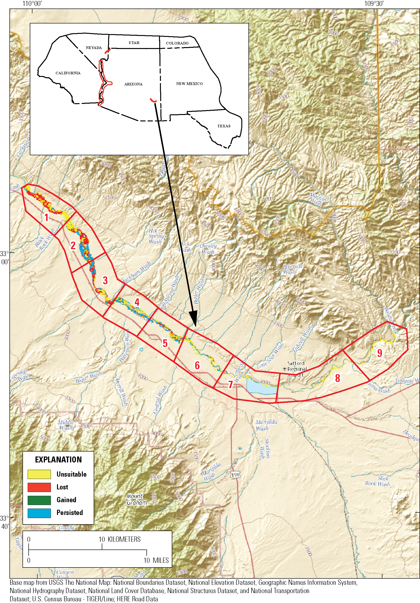
Figure 6. Map showing changes in predicted flycatcher habitat along the upper Gila River after conducting a tamarisk leaf beetle-impact simulation. The upper Gila River was divided into nine zones in order to quantify changes. A satellite model was used to predict flycatcher habitat at a 40-percent probability threshold.
Sources/Usage
Public Domain.
U.S. Geological Survey Open-File Report 2016–1120, 88 p.
Hatten, J.R., 2016, A satellite model of Southwestern Willow Flycatcher (Empidonax traillii extimus) breeding habitat and a simulation of potential effects of tamarisk leaf beetles (Diorhabda spp.), Southwestern United States: U.S. Geological Survey Open-File Report 2016–1120, 88 p.
Related

Southwestern Willow Flycatcher Habitat Viewer
For planning and management purposes, agencies require a web application that can locate, map, and monitor Southwestern Willow Flycatcher (flycatcher) breeding habitat across its range. The Habitat Viewer can identify potential flycatcher habitat and monitor changes caused by stressors, such as beetles, fire or drought.
Related
Southwestern Willow Flycatcher Habitat Viewer
For planning and management purposes, agencies require a web application that can locate, map, and monitor Southwestern Willow Flycatcher (flycatcher) breeding habitat across its range. The Habitat Viewer can identify potential flycatcher habitat and monitor changes caused by stressors, such as beetles, fire or drought.