
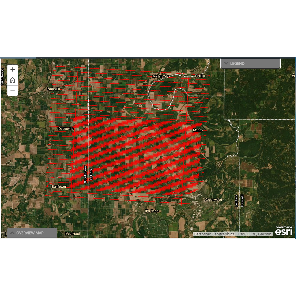
Geophysical Survey Flight Lines and EM Path

Detailed Description
Interactive map screenshot from the geonarrative showing locations where geophysical data were collected for the USGS Mississippi Alluvial Plan project. The geonarrative, Mississippi Alluvial Plain: Shellmound, MS Geophysical Survey, is located at https://apps.usgs.gov/lmg/map/shellmound_SM.html.
Sources/Usage
Public Domain.
Mississippi Alluvial Plain: Shellmound, MS Geophysical Survey
Hoogenboom, B. and Minsley, B., 2020, Mississippi Alluvial Plain: Shellmound, MS Geophysical Survey: U.S. Geological Survey web page, accessed November 16, 2020, at https://apps.usgs.gov/lmg/map/shellmound_SM.html.