
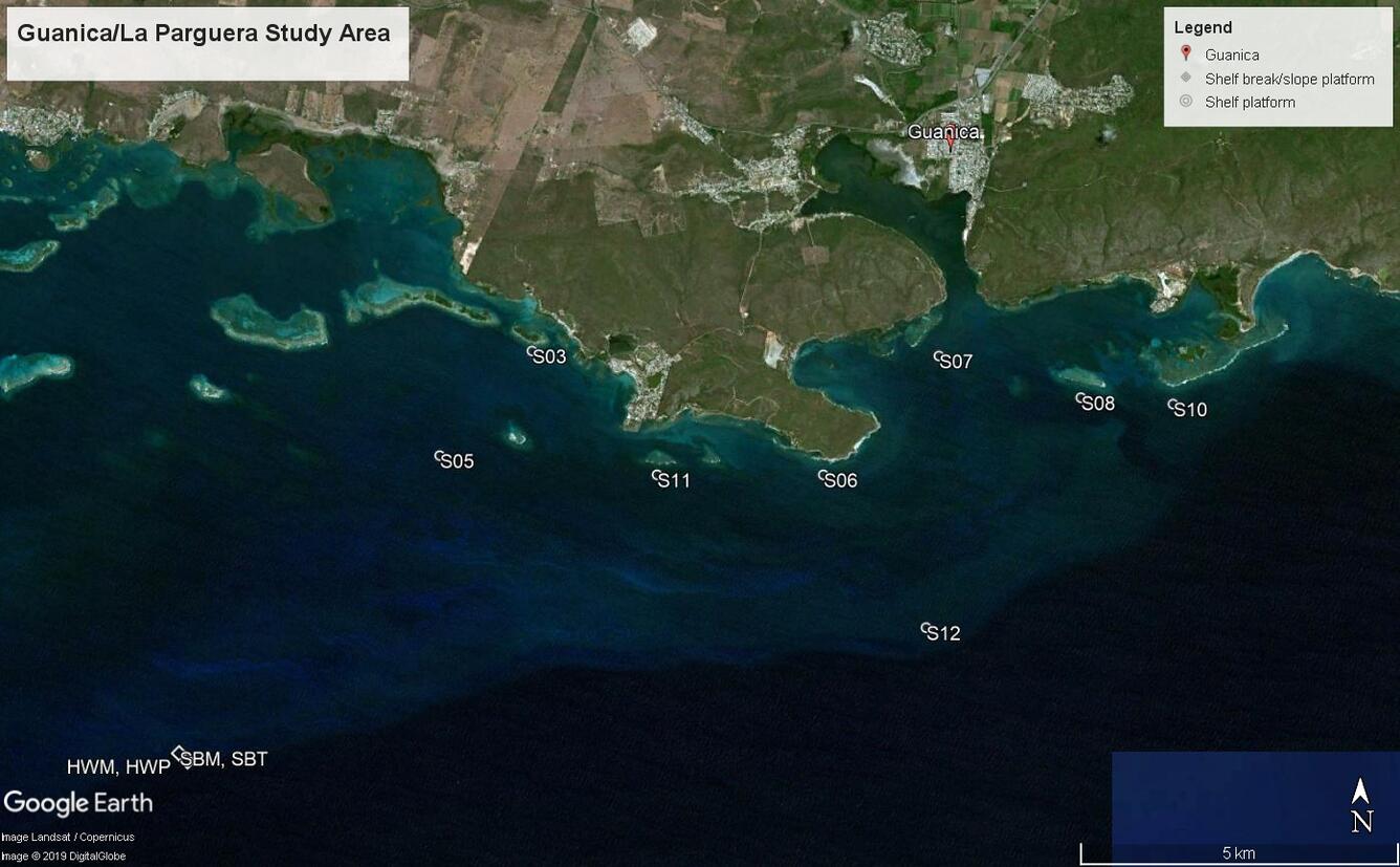
Guanica-La Parguera study area, Puerto Rico
Detailed Description
Map showing locations of instrument platforms that collected oceanographic time series data in La Parguera, Puerto Rico, 2017-2018 during the Coral Reef Circulation and Sediment Dynamics Experiment.
Sources/Usage
Public Domain.
USGS data release
Cheriton, O.M., Rosenberger, K.J., Logan, J.B., and Storlazzi, C.D., 2019, Time series data of oceanographic conditions from La Parguera, Puerto Rico, 2017-2018 Coral Reef Circulation and Sediment Dynamics Experiment: U.S. Geological Survey data release, doi: 10.5066/P9IXOHID.