
Hazard Exposure Reporting and Anlytics web app
Detailed Description
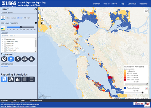
A screen shot of the Hazard Exposure Reporting and Analytics (HERA) application, developed to provide users with insight on potential population, economic, land cover, and infrastructure vulnerability resulting from a given hazard. Interactive maps and graphics allow users to examine hazard exposure for individual communities, to compare the exposure of multiple communities, and to explore changes in community exposure given multiple hazard scenarios.
Sources/Usage
Public Domain.