
High Flow at Cheyenne River near Wasta, SD (06423500) in August 2017
Detailed Description
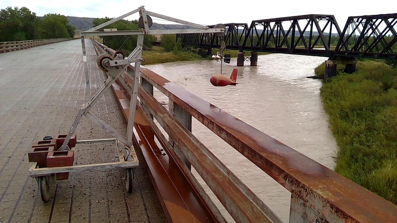
USGS hydrologic technicians measured flow of the Cheyenne River near Wasta, SD, at streamgage 06423500 on August 15, 2017, following heavy storms the previous night. This streamgage measures flows draining from the Black Hills and parts of the Badlands, and has been in continuous operation since March 1934 with some data back to 1914. The peak of record occurred back in May 1932, prior to construction of Angostura Reservoir, at 46,300 cubic feet per second (cfs). The highest flows since the reservoir was constructed was 40,100 cfs in June 1947. More information on this streamgage is available at https://waterdata.usgs.gov/sd/nwis/inventory/?site_no=06423500&agency_cd=USGS&.
Sources/Usage
Public Domain.