
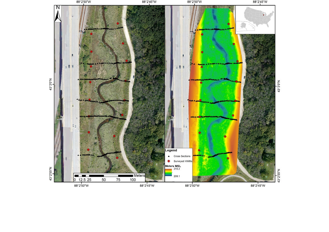
High-water marks and cross-section terrain data at Underwood Creek, WI
Detailed Description
Hight-water marks and cross-sectional terrain data collected by GPS (left) and digital terrain model generated from small unmanned aircraft systems at Underwood Creek, WI. Flow direction is from bottom to top of graphic (south to north).
Sources/Usage
Public Domain.
Using Small Unmanned Aircraft Systems for Measuring Post-Flood High-Water Marks and Streambed Elevations
Figure 5: Forbes, B.T.; DeBenedetto, G.P.; Dickinson, J.E.; Bunch, C.E.; Fitzpatrick, F.A. Using Small Unmanned Aircraft Systems for Measuring Post-Flood High-Water Marks and Streambed Elevations. Remote Sens. 2020, 12, 1437.