
How Do You Landsat with Chinese Forests.png
Detailed Description
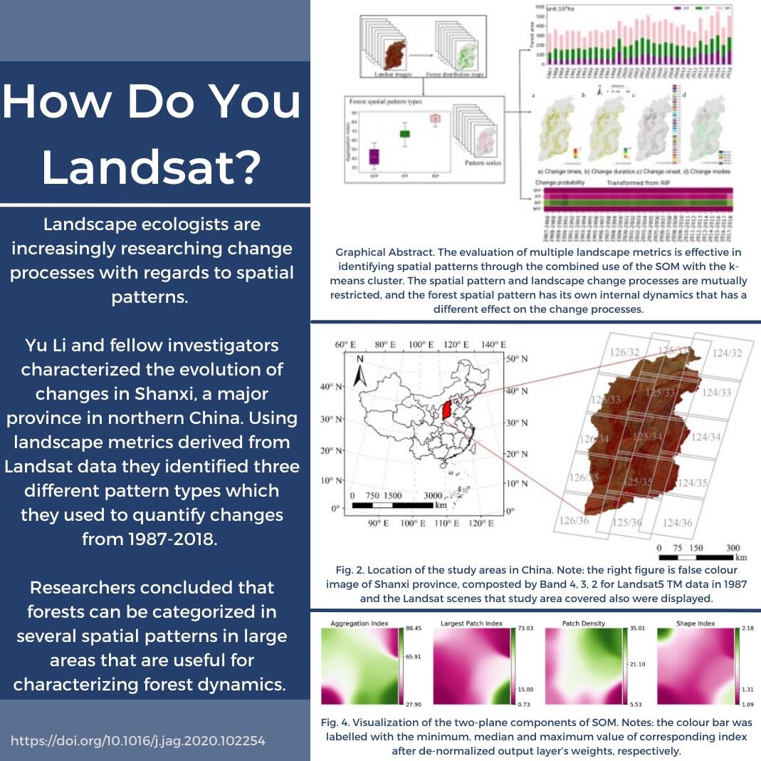
Landscape ecologists are increasingly researching change processes with regards to spatial patterns.
Yu Li and fellow investigators characterized the evolution of changes in Shanxi, a major province in northern China. Using landscape metrics derived from Landsat data they identified three different pattern types which they used to quantify changes from 1987-2018. Researchers concluded that forests can be categorized in several spatial patterns in large areas that are useful for characterizing forest dynamics.
Read the Research: https://www.sciencedirect.com/science/article/pii/S0303243420308977
Sources/Usage
Public Domain.