
Identifying Groundwater Seeps in the Namekagon River in Wisconsin

Detailed Description
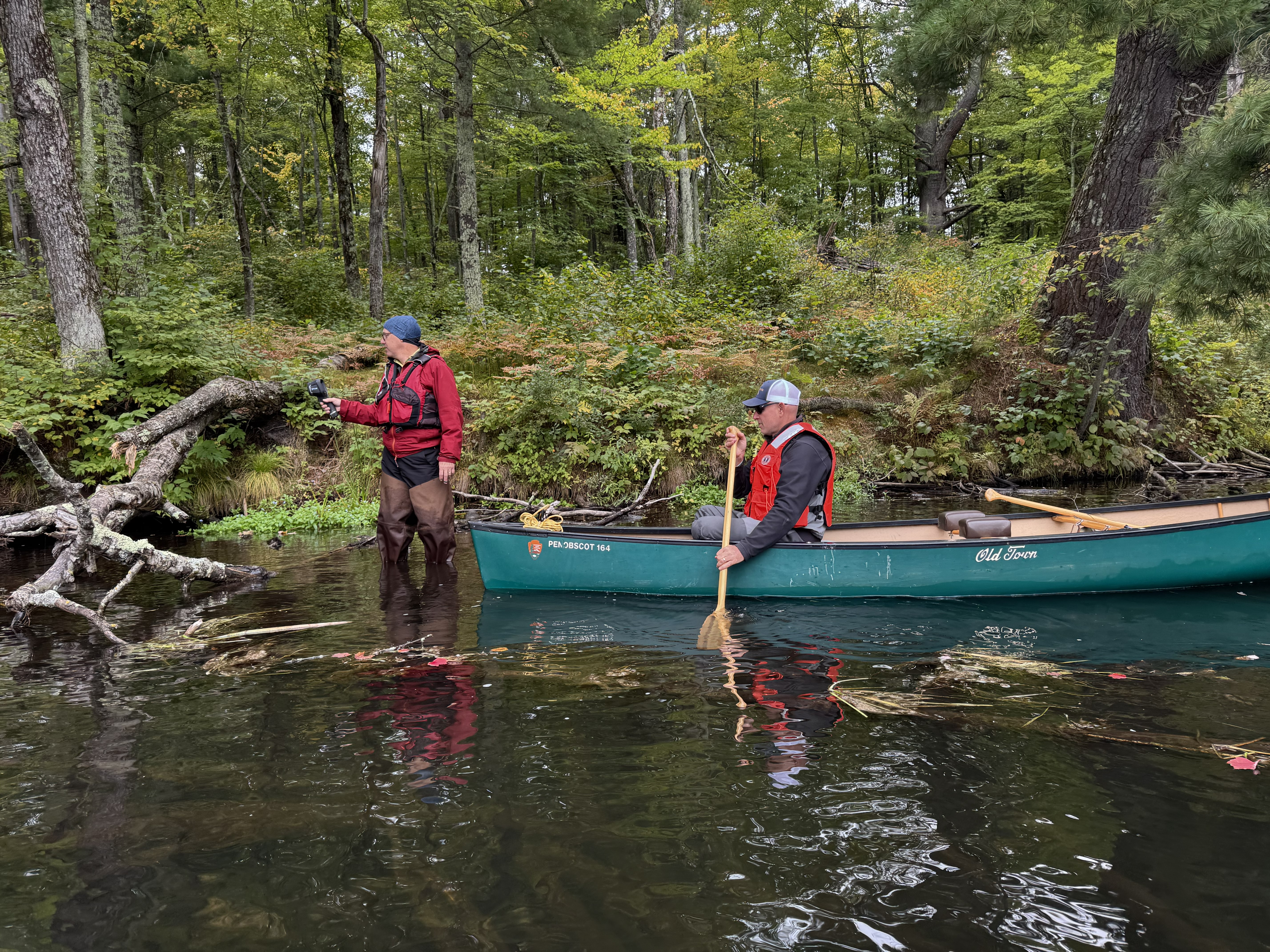
National Park Service Great Lakes Inventory and Monitoring Network (GLKM) biologist Ted Gostomski uses a handheld thermal infrared sensor to identify cold groundwater seeps in the upper Namekagon River near Cable, Wisconsin. Al Kirschbaum, a remote sensing specialist with the NPS-GLKM, documents Gostomski's findings from the canoe. The USGS New England Water Science Center collaborated with the National Park Service to collect thermal imagery along a ~12-mile reach of the upper Namekagon River.
Sources/Usage
Public Domain.
Related
Thermal Imagery to Inform Brook Trout Habitat Suitability and Restoration Potential, Upper Namekagon River, Wisconsin
The U.S. Geological Survey (USGS), in cooperation with the National Park Service (NPS), is using thermal infrared technology to identify cold-water habitat for brook trout and other cold-water species in the upper Namekagon River in Wisconsin. The upper Namekagon River and its tributaries have long served as a stronghold for brook trout and other cold- and cool-water species; however, changing...