



Flight path and thermal imagery displayed on SkydioX10 controller during UAS thermal survey of the Namekagon River, Wisconsin.
Shannon Fisher
Shannon Fisher is a Physical Scientist in the New England Water Science Center.
Shannon is a FAA and DOI licensed remote pilot. She has experience conducting uncrewed aircraft system (UAS) surveys to collect RGB visible light and thermal infrared data used to create georeferenced orthomosaics and structure-from-motion digital surface models. Additionally, Shannon has a background in using passive seismic techniques and GIS mapping to conceptualize the framework of glacial and bedrock aquifer systems.
Science and Products
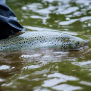
Thermal Imaging to Detect Cold-Water Habitat for Atlantic Salmon and Brook Trout at Katahdin Woods and Waters National Monument
The U.S. Geological Survey (USGS), in cooperation with the National Park Service (NPS), is using airborne thermal infrared remote sensing to characterize cold-water habitat for the federally designated endangered species Atlantic salmon ( Salmo salar) and wild brook trout ( Salvelinus fontinalis) in the East Branch of the Penobscot River system within Katahdin Woods and Waters National Monument...
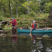
Thermal Imagery to Inform Brook Trout Habitat Suitability and Restoration Potential, Upper Namekagon River, Wisconsin
The U.S. Geological Survey (USGS), in cooperation with the National Park Service (NPS), is using thermal infrared technology to identify cold-water habitat for brook trout and other cold-water species in the upper Namekagon River in Wisconsin. The upper Namekagon River and its tributaries have long served as a stronghold for brook trout and other cold- and cool-water species; however, changing...

Geohydrology of the Valley‐fill Aquifer in the Lower Fall Creek Valley, Town of Dryden, Tompkins County, New York
PROBLEM The valley‐fill aquifer in the lower Fall Creek valley (designated as aquifer 4, fig. 1), within the Towns of Dryden and Groton, was mapped by Miller (2000) and identified as one of 17 unconsolidated aquifers in Tompkins County that need to be studied in more detail. The east end of the valley (near the Tompkins and Cortland County border) is on the backside of a large morainal...

DETAILED AQUIFER MAPPING OF THE SPRINGVILLE, N.Y. AREA Erie, Cattaraugus, and Wyoming Counties, New York
Introduction Public-water systems at Springville and Yorkshire/Delavan, N.Y. along Cattaraugus Creek draw from local groundwater resources and serve about 5,500 people (U.S. EPA SDWIS database). The remainder of the population obtains water from domestic wells, many of them completed in glacial aquifers. A Cattaraugus Creek tributary valley (Buttermilk Creek) to the south is the site of...

DETAILED AQUIFER MAPPING OF THE MALONE, N.Y. AREA (Adirondack foothills and St. Lawrence lowlands transect) Franklin County, New York
Introduction The Village of Malone, Franklin County, New York is located along the Salmon River where it exits the northern foothills of the Adirondack Mountains and flows northward across the St. Lawrence Lowlands until its confluence with the St. Lawrence River. The public water supply of the Village of Malone serves a population of 13,200 (U.S. EPA SDWIS database), which includes...

Detailed Aquifer Mapping in the Susquehanna River Valley in South-Central Broome County –Towns of Conklin and Kirkwood
Introduction Detailed mapping of the valley-fill aquifer within the Susquehanna River valley and adjacent tributary valleys in south-central Broome County (Towns of Conklin and Kirkwood) is the latest study in the cooperative Detailed Aquifer Mapping Program between the US Geological Survey (USGS) and the New York State Department of Environmental Conservation (NYSDEC). The aim of the...
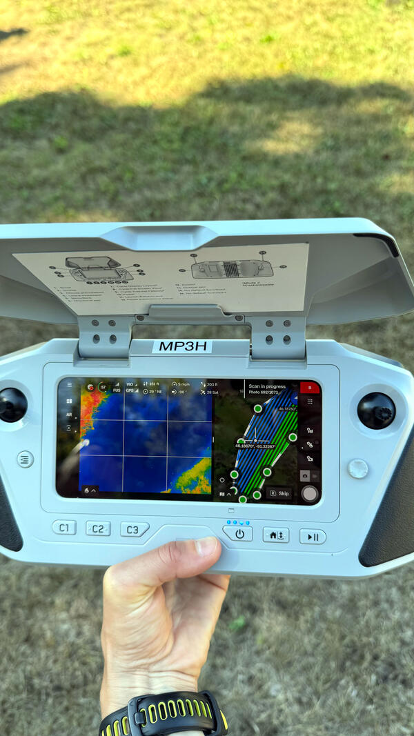
Flight Path on Skydio X10 Controller
Flight path and thermal imagery displayed on SkydioX10 controller during UAS thermal survey of the Namekagon River, Wisconsin.
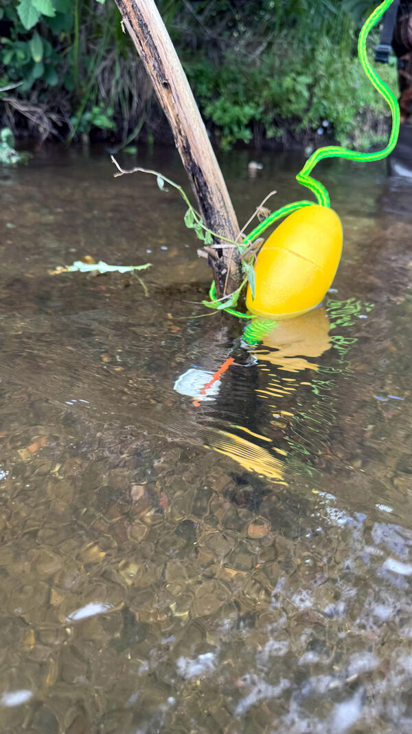
Temperature Data Logger
Temperature data logger deployed in Namekagon River, Wisconsin.
Temperature data logger deployed in Namekagon River, Wisconsin.
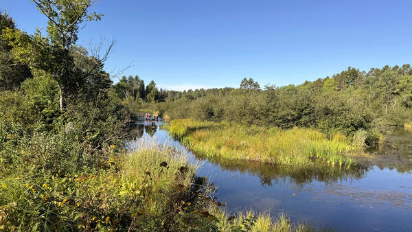
Ground Control Survey
GNSS RTK survey of ground control points deployed near Cable Wayside landing, Namekagon River, Wisconsin.
GNSS RTK survey of ground control points deployed near Cable Wayside landing, Namekagon River, Wisconsin.
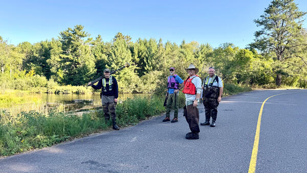
GNSS Survey Team
GNSS survey team at Cable Wayside Landing, Namekagon River, Wisconsin.
GNSS survey team at Cable Wayside Landing, Namekagon River, Wisconsin.
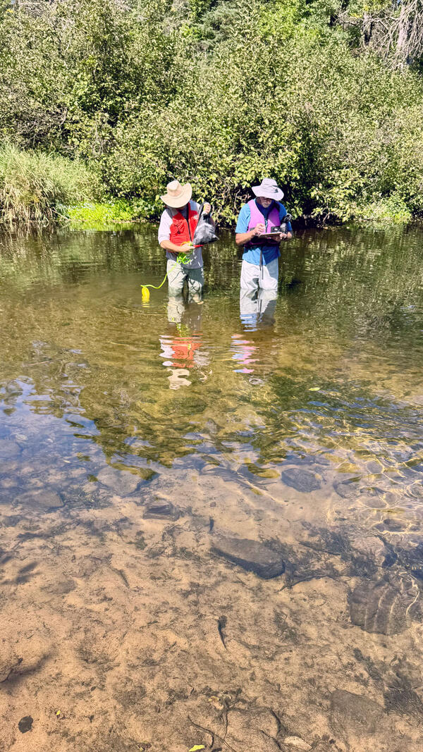
Deploying Data Logger
Deploying data logger in known cold-water zone actively used by brook trout for thermal relief, Namekagon River, Wisconsin.
Deploying data logger in known cold-water zone actively used by brook trout for thermal relief, Namekagon River, Wisconsin.
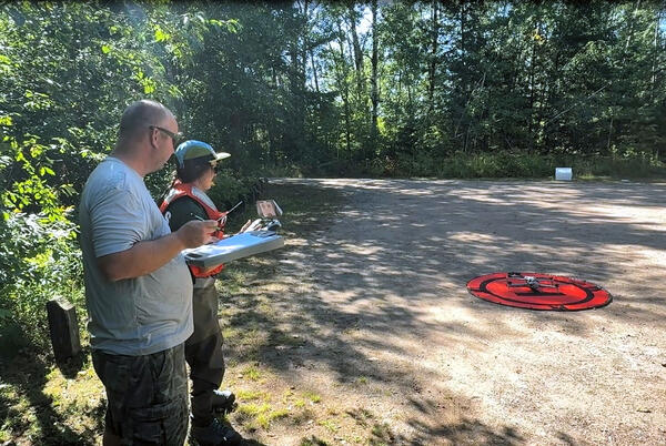
UAS launch at Cap Creek
USGS reviewing pre-flight checklist before launching uncrewed aircraft system (UAS) at Cap Creek landing on the Namekagon River, Wisconsin.
USGS reviewing pre-flight checklist before launching uncrewed aircraft system (UAS) at Cap Creek landing on the Namekagon River, Wisconsin.
AeroPoint Collection
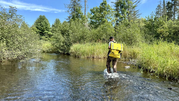
Collecting AeroPoints deployed along the Namekagon River, Wisconsin.
Collecting AeroPoints deployed along the Namekagon River, Wisconsin.
Namekagon River
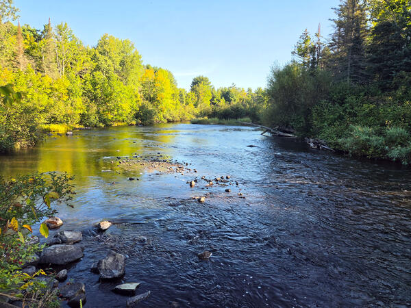
Namekagon River at Leonard School Road, Wisconsin.
Namekagon River at Leonard School Road, Wisconsin.
Aerial view of a fish research laboratory
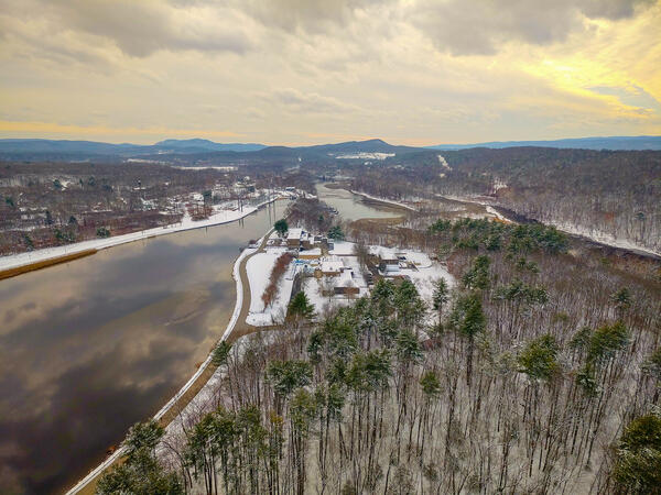
Aerial view of the USGS S.O. Conte Anadromous Fish Research Laboratory and Connecticut River at Turners Falls, Massachusetts.
Fall 2025 Photo Contest Winner: Shannon Fisher, Honorable Mention category
Aerial view of the USGS S.O. Conte Anadromous Fish Research Laboratory and Connecticut River at Turners Falls, Massachusetts.
Fall 2025 Photo Contest Winner: Shannon Fisher, Honorable Mention category
Locating a Groundwater Seep in Namekagon River in Cable, Wisconsin
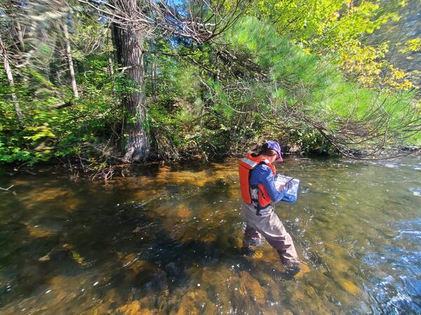
Locating a Groundwater Seep in Namekagon River in Cable, WisconsinUSGS New England Water Science Center physical scientist Shannon Fisher documenting the location of a groundwater seep under a pine tree on the Namekagon River near Cable, Wisconsin.
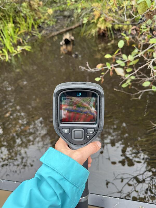
Using a Thermal Infrared Camera to Identify Groundwater Seeps in the Namegagon River
Using a Thermal Infrared Camera to Identify Groundwater Seeps in the Namegagon RiverCold groundwater seep identified using a handheld thermal infrared camera (FLIR E8) on the upper Namekagon River near Cable, Wisconsin. The groundwater discharge area was about 7-8 degrees cooler than the main channel of the Namekagon.
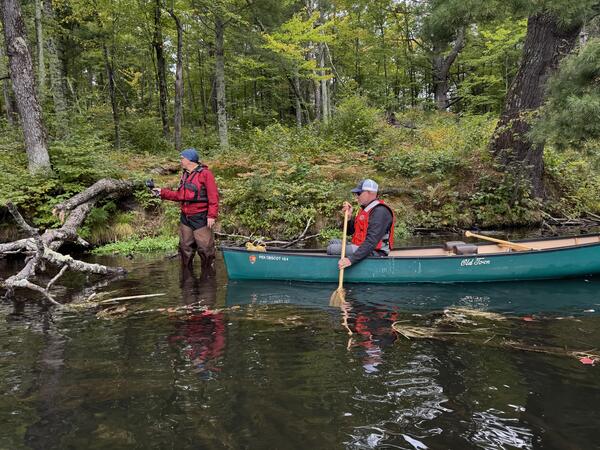
Identifying Groundwater Seeps in the Namekagon River in Wisconsin
Identifying Groundwater Seeps in the Namekagon River in WisconsinNational Park Service Great Lakes Inventory and Monitoring Network (GLKM) biologist Ted Gostomski uses a handheld thermal infrared sensor to identify cold groundwater seeps in the upper Namekagon River near Cable, Wisconsin. Al Kirschbaum, a remote sensing specialist with the NPS-GLKM, documents Gostomski's findings from the canoe.

Hydraulic Channel Geometry of Selected Tidal Rivers in Coastal Massachusetts - Northeast Aquatic Biologists Annual Conference, 2025
Hydraulic Channel Geometry of Selected Tidal Rivers in Coastal Massachusetts - Northeast Aquatic Biologists Annual Conference, 2025The U.S.
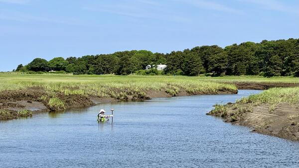
Surveying the tidal at Boat Meadow River
Andy Massey, Physical Scientist at the New England Water Science Center, surveying the tidal Boat Meadow River in Eastham, Massachusetts on June 14, 2024.
Summer 2024 Photo Contest Winner: Shannon Fisher, USGS at Work
Andy Massey, Physical Scientist at the New England Water Science Center, surveying the tidal Boat Meadow River in Eastham, Massachusetts on June 14, 2024.
Summer 2024 Photo Contest Winner: Shannon Fisher, USGS at Work
Science and Products
Thermal Imaging to Detect Cold-Water Habitat for Atlantic Salmon and Brook Trout at Katahdin Woods and Waters National Monument
The U.S. Geological Survey (USGS), in cooperation with the National Park Service (NPS), is using airborne thermal infrared remote sensing to characterize cold-water habitat for the federally designated endangered species Atlantic salmon ( Salmo salar) and wild brook trout ( Salvelinus fontinalis) in the East Branch of the Penobscot River system within Katahdin Woods and Waters National Monument...
Thermal Imagery to Inform Brook Trout Habitat Suitability and Restoration Potential, Upper Namekagon River, Wisconsin
The U.S. Geological Survey (USGS), in cooperation with the National Park Service (NPS), is using thermal infrared technology to identify cold-water habitat for brook trout and other cold-water species in the upper Namekagon River in Wisconsin. The upper Namekagon River and its tributaries have long served as a stronghold for brook trout and other cold- and cool-water species; however, changing...
Geohydrology of the Valley‐fill Aquifer in the Lower Fall Creek Valley, Town of Dryden, Tompkins County, New York
PROBLEM The valley‐fill aquifer in the lower Fall Creek valley (designated as aquifer 4, fig. 1), within the Towns of Dryden and Groton, was mapped by Miller (2000) and identified as one of 17 unconsolidated aquifers in Tompkins County that need to be studied in more detail. The east end of the valley (near the Tompkins and Cortland County border) is on the backside of a large morainal...
DETAILED AQUIFER MAPPING OF THE SPRINGVILLE, N.Y. AREA Erie, Cattaraugus, and Wyoming Counties, New York
Introduction Public-water systems at Springville and Yorkshire/Delavan, N.Y. along Cattaraugus Creek draw from local groundwater resources and serve about 5,500 people (U.S. EPA SDWIS database). The remainder of the population obtains water from domestic wells, many of them completed in glacial aquifers. A Cattaraugus Creek tributary valley (Buttermilk Creek) to the south is the site of...
DETAILED AQUIFER MAPPING OF THE MALONE, N.Y. AREA (Adirondack foothills and St. Lawrence lowlands transect) Franklin County, New York
Introduction The Village of Malone, Franklin County, New York is located along the Salmon River where it exits the northern foothills of the Adirondack Mountains and flows northward across the St. Lawrence Lowlands until its confluence with the St. Lawrence River. The public water supply of the Village of Malone serves a population of 13,200 (U.S. EPA SDWIS database), which includes...
Detailed Aquifer Mapping in the Susquehanna River Valley in South-Central Broome County –Towns of Conklin and Kirkwood
Introduction Detailed mapping of the valley-fill aquifer within the Susquehanna River valley and adjacent tributary valleys in south-central Broome County (Towns of Conklin and Kirkwood) is the latest study in the cooperative Detailed Aquifer Mapping Program between the US Geological Survey (USGS) and the New York State Department of Environmental Conservation (NYSDEC). The aim of the...
Flight Path on Skydio X10 Controller
Flight path and thermal imagery displayed on SkydioX10 controller during UAS thermal survey of the Namekagon River, Wisconsin.
Flight path and thermal imagery displayed on SkydioX10 controller during UAS thermal survey of the Namekagon River, Wisconsin.
Temperature Data Logger
Temperature data logger deployed in Namekagon River, Wisconsin.
Temperature data logger deployed in Namekagon River, Wisconsin.
Ground Control Survey
GNSS RTK survey of ground control points deployed near Cable Wayside landing, Namekagon River, Wisconsin.
GNSS RTK survey of ground control points deployed near Cable Wayside landing, Namekagon River, Wisconsin.
GNSS Survey Team
GNSS survey team at Cable Wayside Landing, Namekagon River, Wisconsin.
GNSS survey team at Cable Wayside Landing, Namekagon River, Wisconsin.
Deploying Data Logger
Deploying data logger in known cold-water zone actively used by brook trout for thermal relief, Namekagon River, Wisconsin.
Deploying data logger in known cold-water zone actively used by brook trout for thermal relief, Namekagon River, Wisconsin.
UAS launch at Cap Creek
USGS reviewing pre-flight checklist before launching uncrewed aircraft system (UAS) at Cap Creek landing on the Namekagon River, Wisconsin.
USGS reviewing pre-flight checklist before launching uncrewed aircraft system (UAS) at Cap Creek landing on the Namekagon River, Wisconsin.
AeroPoint Collection
Collecting AeroPoints deployed along the Namekagon River, Wisconsin.
Collecting AeroPoints deployed along the Namekagon River, Wisconsin.
Namekagon River
Namekagon River at Leonard School Road, Wisconsin.
Namekagon River at Leonard School Road, Wisconsin.
Aerial view of a fish research laboratory
Aerial view of the USGS S.O. Conte Anadromous Fish Research Laboratory and Connecticut River at Turners Falls, Massachusetts.
Fall 2025 Photo Contest Winner: Shannon Fisher, Honorable Mention category
Aerial view of the USGS S.O. Conte Anadromous Fish Research Laboratory and Connecticut River at Turners Falls, Massachusetts.
Fall 2025 Photo Contest Winner: Shannon Fisher, Honorable Mention category
Locating a Groundwater Seep in Namekagon River in Cable, Wisconsin
Locating a Groundwater Seep in Namekagon River in Cable, WisconsinUSGS New England Water Science Center physical scientist Shannon Fisher documenting the location of a groundwater seep under a pine tree on the Namekagon River near Cable, Wisconsin.
Using a Thermal Infrared Camera to Identify Groundwater Seeps in the Namegagon River
Using a Thermal Infrared Camera to Identify Groundwater Seeps in the Namegagon RiverCold groundwater seep identified using a handheld thermal infrared camera (FLIR E8) on the upper Namekagon River near Cable, Wisconsin. The groundwater discharge area was about 7-8 degrees cooler than the main channel of the Namekagon.
Identifying Groundwater Seeps in the Namekagon River in Wisconsin
Identifying Groundwater Seeps in the Namekagon River in WisconsinNational Park Service Great Lakes Inventory and Monitoring Network (GLKM) biologist Ted Gostomski uses a handheld thermal infrared sensor to identify cold groundwater seeps in the upper Namekagon River near Cable, Wisconsin. Al Kirschbaum, a remote sensing specialist with the NPS-GLKM, documents Gostomski's findings from the canoe.
Hydraulic Channel Geometry of Selected Tidal Rivers in Coastal Massachusetts - Northeast Aquatic Biologists Annual Conference, 2025
Hydraulic Channel Geometry of Selected Tidal Rivers in Coastal Massachusetts - Northeast Aquatic Biologists Annual Conference, 2025The U.S.
Surveying the tidal at Boat Meadow River
Andy Massey, Physical Scientist at the New England Water Science Center, surveying the tidal Boat Meadow River in Eastham, Massachusetts on June 14, 2024.
Summer 2024 Photo Contest Winner: Shannon Fisher, USGS at Work
Andy Massey, Physical Scientist at the New England Water Science Center, surveying the tidal Boat Meadow River in Eastham, Massachusetts on June 14, 2024.
Summer 2024 Photo Contest Winner: Shannon Fisher, USGS at Work
*Disclaimer: Listing outside positions with professional scientific organizations on this Staff Profile are for informational purposes only and do not constitute an endorsement of those professional scientific organizations or their activities by the USGS, Department of the Interior, or U.S. Government