
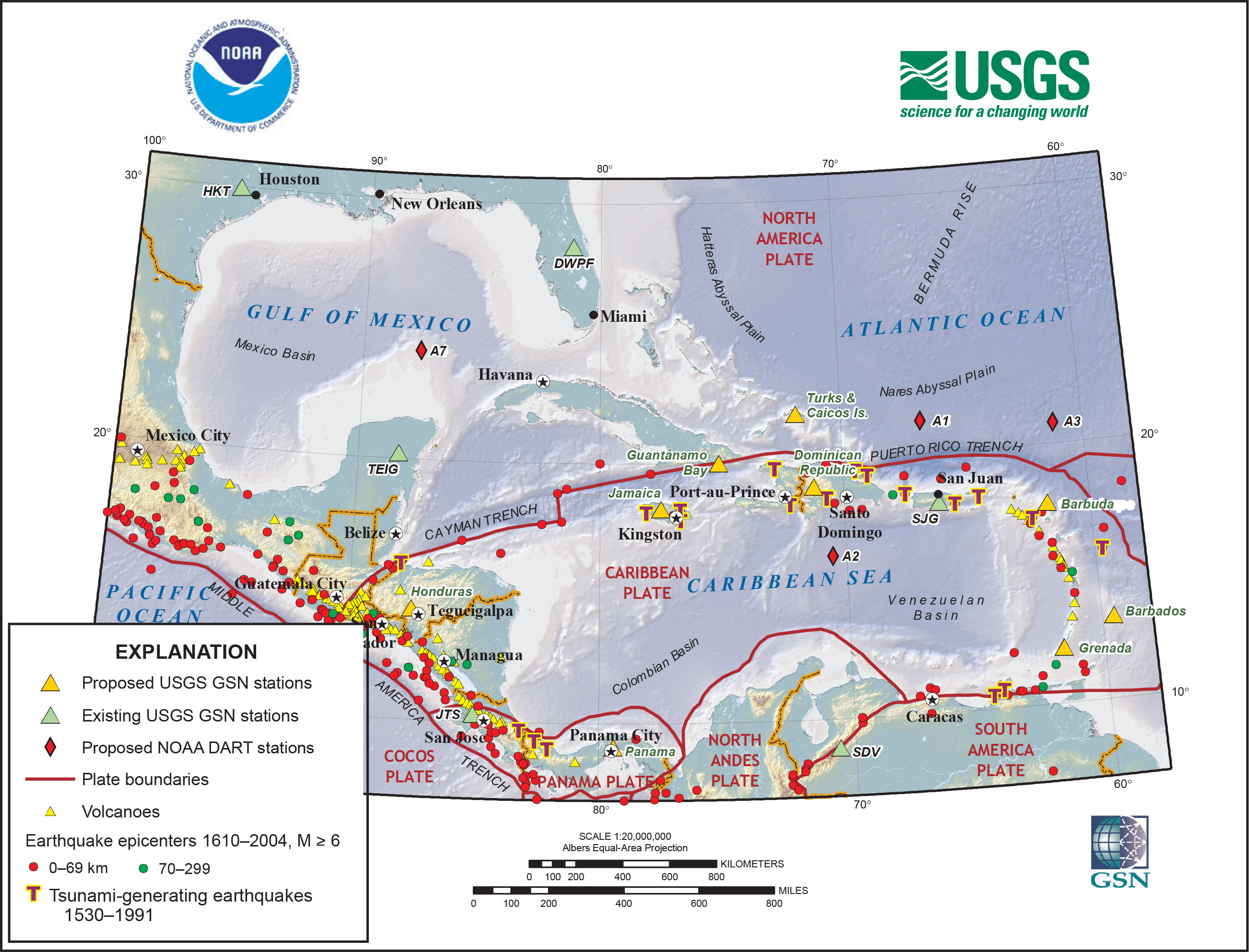
Improved earthquake and tsunami monitoring in the Caribbean

Detailed Description
Improved earthquake and tsunami monitoring in the Caribbean. The map shows the seismicity and tectonic setting of the region as well as planned USGS and NOAA monitoring stations. The planned seismic stations will be affiliated with the Global Seismographic Network (GSN), which is funded jointly by the National Science Foundation and the USGS. NOAA’s National Data Buoy Center operates DART (Deep-ocean Assessment and Reporting of Tsunamis) stations.
Sources/Usage
Public Domain.
Improving earthquake and tsunami warnings for the Caribbean Sea, the Gulf of Mexico, and the Atlantic coast
USGS Fact Sheet 2006-3012: The magnitude-9 Sumatra-Andaman Islands earthquake of December 26, 2004, increased awareness in the United States of the destructive hazard posed by earthquakes and tsunamis. The U.S. Government, working with international partners, is responding with a real-time system that will significantly improve global earthquake and tsunami monitoring. This fact sheet describes a project for earthquake and tsunami monitoring along a major portion of our vulnerable coastal regions, the Caribbean Sea, the Gulf of Mexico, and the Atlantic Ocean. The project is a result of collaboration between the U.S. Geological Survey and the National Oceanic and Atmospheric Administration (NOAA).