
July 2007 Eruption--Flow Field Map: July 22, 2010
Detailed Description
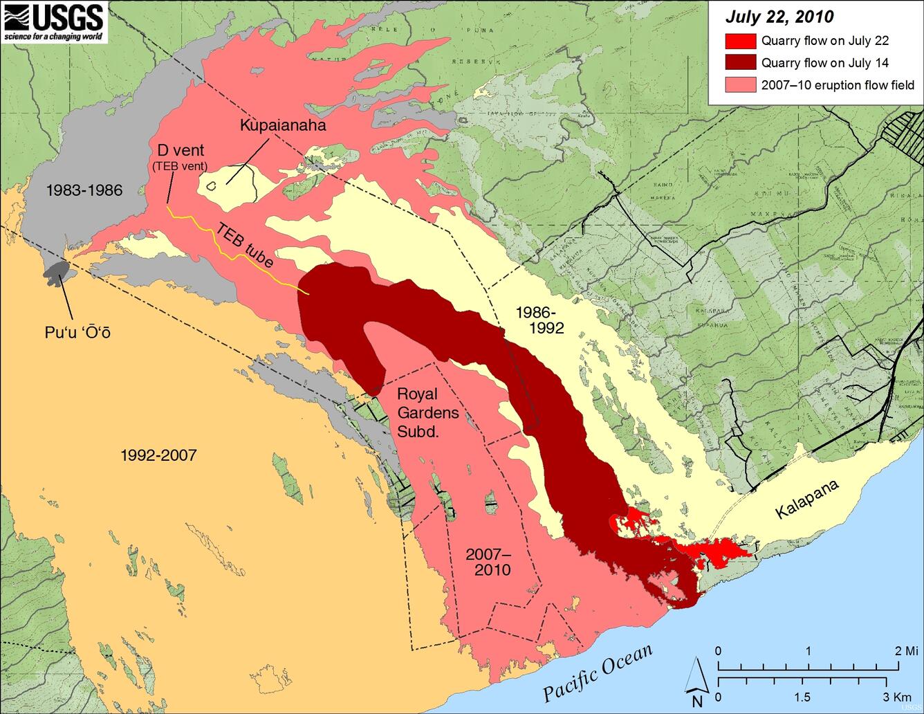
Map showing the extent of the July 2007 eruption flow field relative to surrounding communities. Light red is the extent of the July 2007 eruption flow field. Reddish-brown is the extent of the currently-active Quarry flow as of July 14, 2010, while bright red shows the flow field expansion of the Quarry flow mapped by HVO geologists between July 14 and July 22. Flows erupted earlier during the 1983-present Pu`u `Ō`ō-Kupaianaha eruption are shown in more muted colors and labeled with the years in which they were active.
Sources/Usage
Public Domain.