
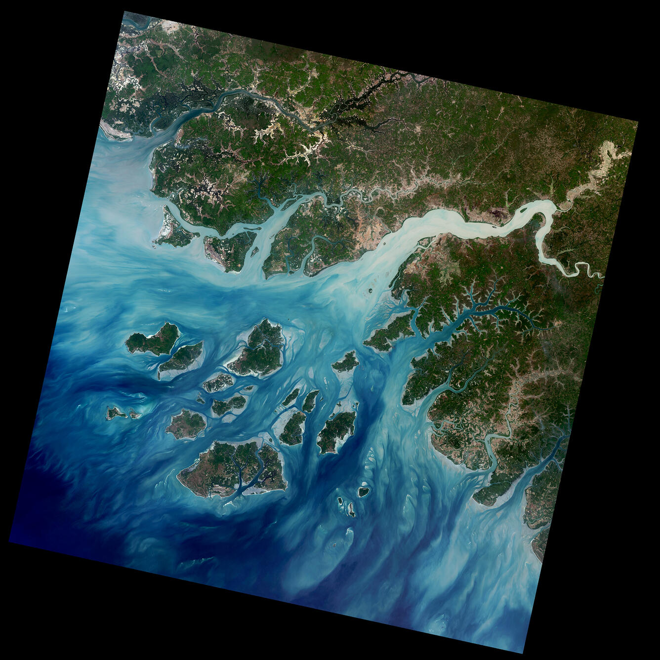
Landsat 9 Image of Western Guinea-Bissau
Detailed Description
The Geba River on the west coast of Guinea-Bissau is seen in this natural color Landsat 9 image from February 8, 2022. Silt carried by the river into the Atlantic Ocean creates intricate patterns as it moves around the Bissagos (or Bijagós) Islands. The country’s capital, Bissau, can be seen on the north side of the estuary and appears as light brown.
Learn more about the mission on the Landsat 9 web page
Sources/Usage
Public Domain.