
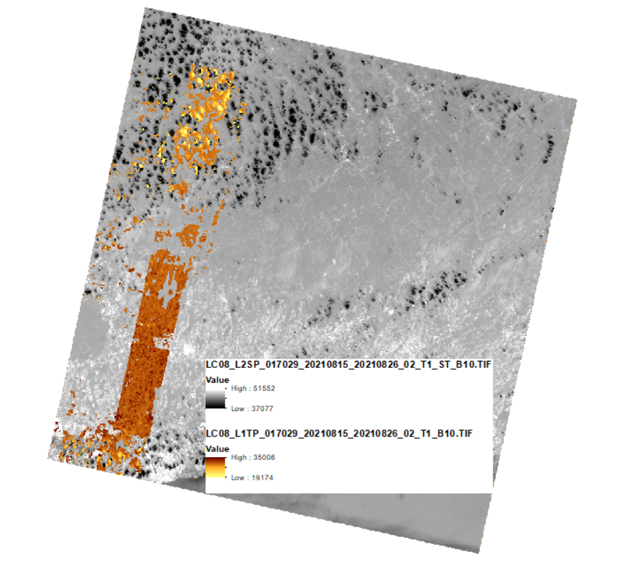
Landsat Collection 2 Level-2 Surface Temperature data displayed with Level-1 data

Detailed Description
To illustrate how missing ASTER GED data propagates to Landsat Collection 2 Surface Temperature (ST) products, this image shows the Level-2 Landsat Surface Temperature product layered over the Level-1 thermal radiance Band 10 image for Landsat 8, Path 17 Row 29, acquired August 26, 2021. The orange areas indicate missing ST data, due to missing ASTER GED emissivity data.
Visit Landsat Collection 2 Surface Temperature data gaps due to missing ASTER GED page to learn more.
Sources/Usage
Public Domain.