
Landsat Collection 2 Surface Temperature data gaps due to missing ASTER GED
Landsat Collection 2 Surface Temperature (ST) products are generated from several input data sources and atmospheric profiles, this includes NASA’s Advanced Spaceborne Thermal Emission and Reflection Radiometer (ASTER) Global Emissivity Dataset (GED).
Return to Landsat Collection 2 Surface Temperature Overview
ASTER GED contains areas of missing mean emissivity data required for successful ST product generation. If there is missing ASTER GED information, there will be missing ST data in those areas.
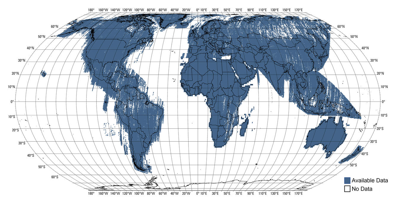
The ASTER GED dataset is created from all clear-sky pixels of ASTER scenes acquired from 2000 through 2008. While this dataset has a global spatial extent, there are areas missing mean emissivity information due to persistent cloud contamination in the ASTER measurements.
The USGS further screens unphysical values (emissivity < 0.6) in ASTER GED to remove any emissivity underestimation due to undetected clouds. For any given pixel with no ASTER GED input or unphysical emissivity value, the resulting Landsat ST products have missing pixels. The missing Landsat ST pixels will be consistent through time (1982-present) given the static nature of ASTER GED mean climatology data.
The image below displays global ASTER GED coverage.
The images below illustrate how missing ASTER GED data propagates to the ST product for Landsat 8, Path 17 Row 29, acquired August 26, 2021. Left: This image displays the Level-2 Landsat Surface Temperature product layered over the Level-1 thermal radiance Band 10 image. Orange areas indicate missing ST data, due to missing ASTER GED emissivity data. Right: this image displays corresponding ASTER GED tiles layered over the Landsat Collection 2 Level-2 Surface Temperature Band 10 image. The red areas indicate missing pixels in the ASTER GED data.


ASTER GED data can be downloaded to investigate missing Landsat ST pixels. ASTER GED data access information can be found on https://lpdaac.usgs.gov/products/ag100v003/. Information about scripting capabilities are available from https://lpdaac.usgs.gov/tools/data-prep-scripts/.
Users are encouraged to contact USGS Customer Services with additional issues discovered or questions about the Collection 2 Landsat ST product.