
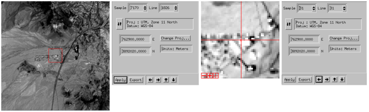
Landsat Ground Control Point Structure Sample
Detailed Description
This image is a sample image showing the structure of a Landsat Ground Control Point (GCP). GCPs are defined as points on the surface of the earth of known location used to geo-reference Landsat Level-1 data.
Visit the Landsat Ground Control Points page for more information.
Sources/Usage
Public Domain.