
Landsat Records Historic World Trade Center Attack
Detailed Description
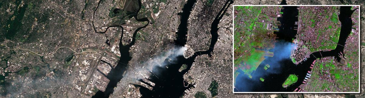
This true-color image was taken by the Enhanced Thematic Mapper Plus (ETM+) sensor aboard the Landsat 7 satellite on September 12, 2001, at roughly 11:30 a.m. Eastern Daylight Savings Time. A day after the attack, smoke continues to billow out of the collapsed Twin Towers.
Sources/Usage
Public Domain.
Related

Environmental Studies of the World Trade Center Area After the September 11, 2001 Attack
USGS scientists conducted a remote sensing and mineralogical characterization study of lower Manhattan around the WTC after the September 11, 2001 attack.
Related
Environmental Studies of the World Trade Center Area After the September 11, 2001 Attack
USGS scientists conducted a remote sensing and mineralogical characterization study of lower Manhattan around the WTC after the September 11, 2001 attack.