
Liquefaction probabilities for a portion of the SF Bay region
Detailed Description
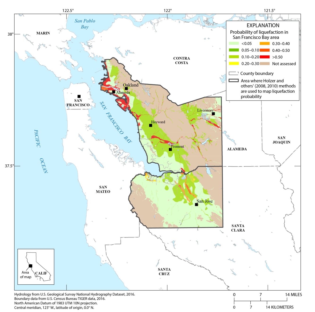
Map of the San Francisco Bay region, California, showing liquefaction (soils becoming liquid-like during shaking) probabilities for western Alameda and northern Santa Clara Counties as a result of strong ground shaking during the hypothetical magnitude-7 mainshock of the HayWired earthquake scenario on the Hayward Fault. <, less than; >, greater than. (From Jones and others, this volume.)
Sources/Usage
Public Domain.