
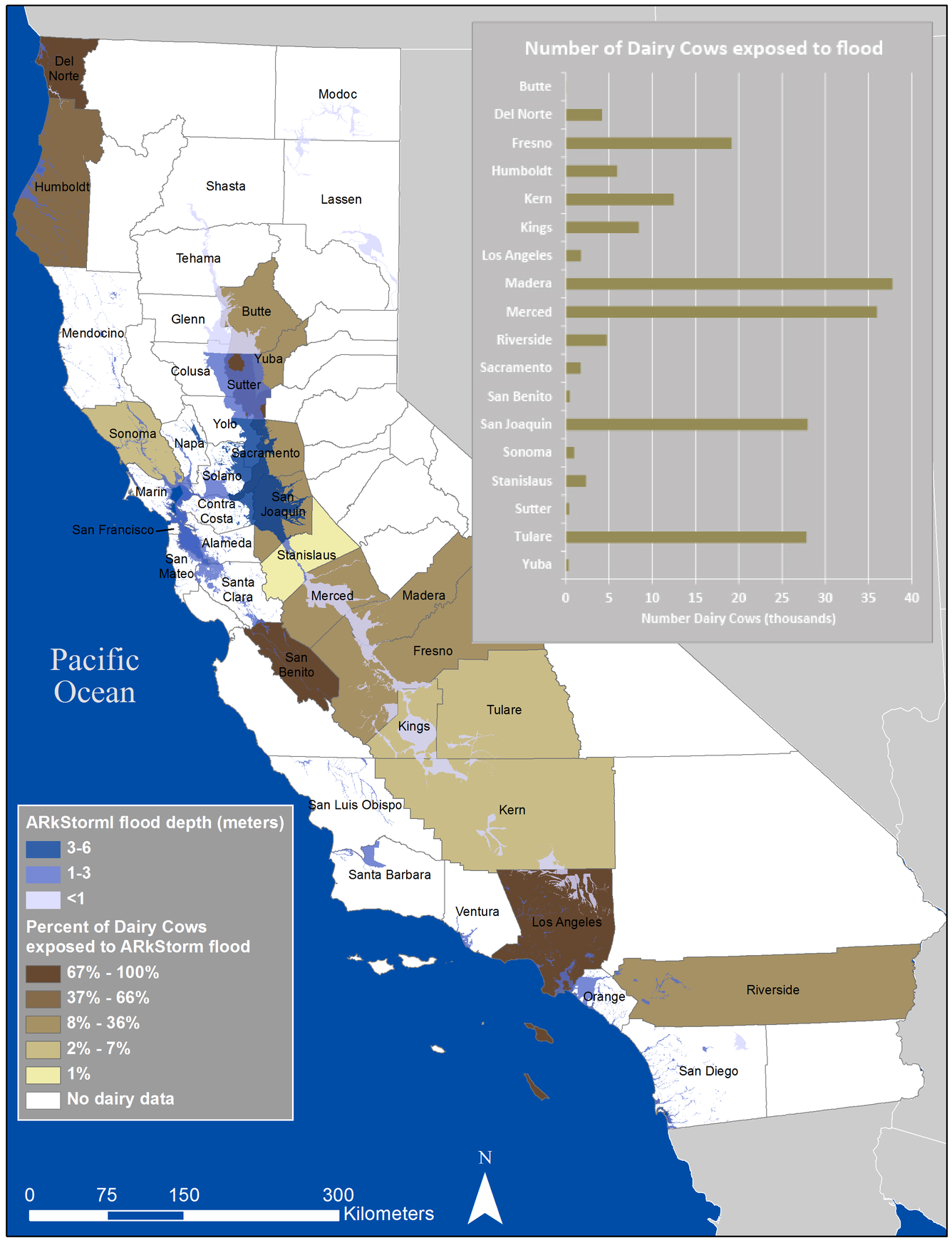
Map and graph of ARkStorm dairy exposure estimates
By Western Geographic Science Center
2014 (approx.)
Detailed Description
Map and graph of estimated at-risk dairy cows by county due to ARkStorm scenario flooding presents an evacuation challenge.
Sources/Usage
Public Domain.