
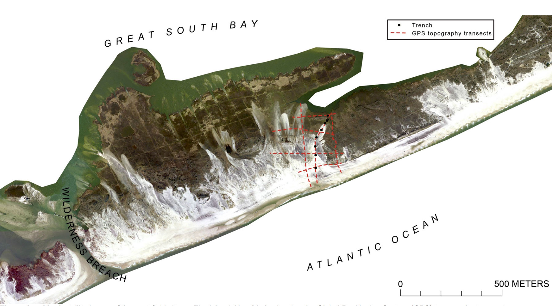
Map/satellite image of the east field site on Fire Island, New York

Detailed Description
Map/satellite image of the east field site on Fire Island, New York, showing the Global Positioning System (GPS) topography transects (dashed red lines) and trenches (black dots).
Sources/Usage
Open-File Report 2017-1014
Open-File Report 2017-1014