
Mock-up of a boresight flight path
Detailed Description
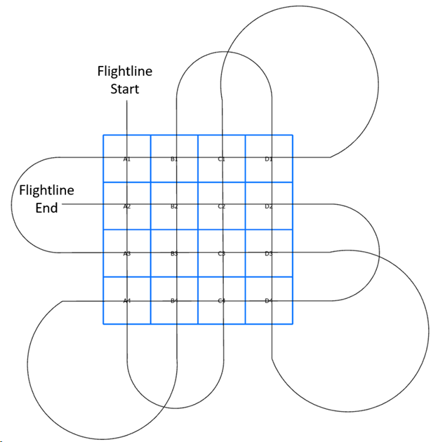
Figure 1: A mocked-up boresight showing how an airplane with an installed aerial camera system would cover the boresight installation to collect imagery of all quadrants (A1 – D4) while also ensuring overlapping photography is gathered.
Sources/Usage
Public Domain.
Photographer - Andrew Strassman, USGS, Biologist, astrassman@usgs.gov
Related

Aerial Camera System Boresight Development and Deployment
Plane-mounted aerial camera systems are used across the U.S. Department of the Interior for science, resource monitoring, emergency management, and disaster recovery, among many other applications. A critical step in deploying aerial cameras is calibrating these systems to ground control points (GCP). This allows the camera systems, when combined with photo rectification software, to precisely...
Related
Aerial Camera System Boresight Development and Deployment
Plane-mounted aerial camera systems are used across the U.S. Department of the Interior for science, resource monitoring, emergency management, and disaster recovery, among many other applications. A critical step in deploying aerial cameras is calibrating these systems to ground control points (GCP). This allows the camera systems, when combined with photo rectification software, to precisely...