
National Seismic Hazard Model
Detailed Description
NATIONAL SEISMIC HAZARD MODEL
The National Seismic Hazard Model stands as a testament to scientific innovation in the service of public safety. This congressionally requested update provides an essential tool to many stakeholders by showing where large earthquakes are most likely to occur, allowing for better mitigation and preparedness in those areas.
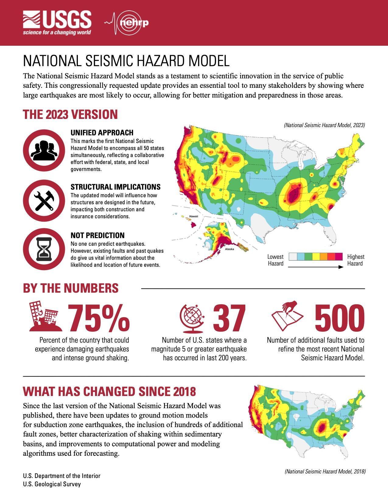
THE 2023 VERSION
- UNIFIED APPROACH - This marks the first National Seismic Hazard Model to encompass all 50 states simultaneously, reflecting a collaborative effort with federal, state, and local governments.
- STRUCTURAL IMPLICATIONS - The updated model will influence how structures are designed in the future, impacting both construction and insurance considerations.
- NOT PREDICTION - No one can predict earthquakes. However, existing faults and past quakes do give us vital information about the likelihood and location of future events.
BY THE NUMBERS
- 75% - Percent of the country that could experience damaging earthquakes and intense ground shaking.
- 37 - Number of U.S. states where a magnitude 5 or greater earthquake has occurred in last 200 years.
- 500 - Number of additional faults used to refine the most recent National Seismic Hazard Model.
WHAT HAS CHANGED SINCE 2018
Since the last version of the National Seismic Hazard Model was published, there have been updates to ground motion models for subduction zone earthquakes, the inclusion of hundreds of additional fault zones, better characterization of shaking within sedimentary basins, and improvements to computational power and modeling algorithms used for forecasting.
Sources/Usage
Public Domain.