
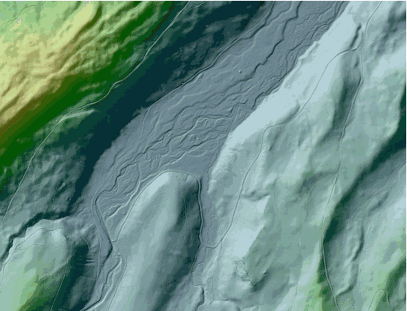
Pole Creek Fire
Detailed Description
GIF showing an aerial orthophoto of the area around the Pole Creek Fire in Oregon combined with a shaded relief image from lidar. Features that are impossible to identify from airborne imagery become very evident when using lidar. Aerial orthophoto source is the U.S. Department of Agriculture's National Agriculture Imagery Program. Lidar source is USGS.