
PRISM3 Site Locations

Detailed Description
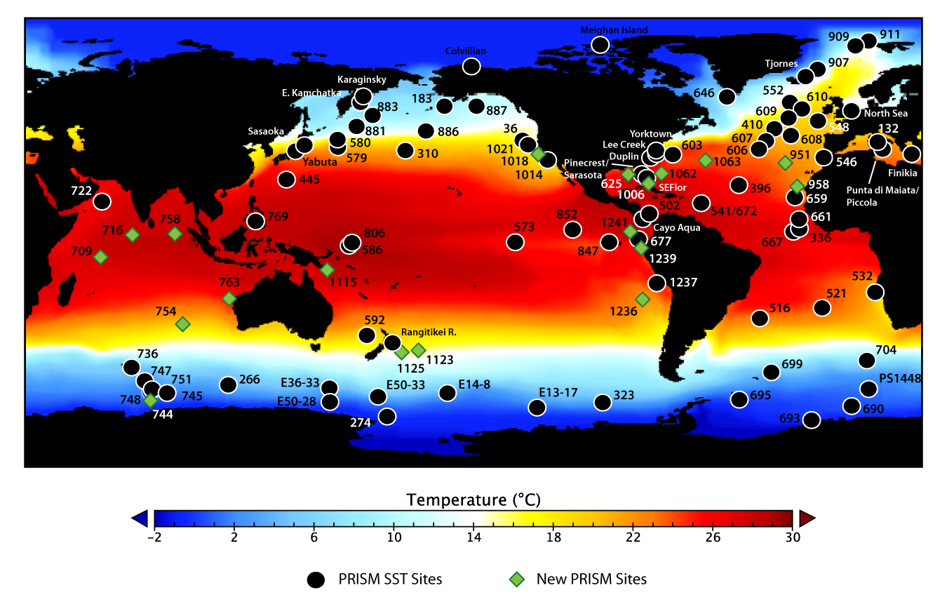
Image: PRISM3 site locations displayed on PRISM3 Mean Annual SST.
PRISM3 was the main USGS contribution to a USGS/NSF/NASA collaborative effort. PRISM3 incorporated improvements to the SST and Sea-Ice data as well as increased coverage in the Vegetation data. The SST data has been enhanced by the construction of maximum and minimum probable warming data sets that bracket the range of variability in Pliocene SST. The most significant change was the inclusion of deep-water temperatures and a three-dimensional ocean (PRISM3D). The next generation of fully coupled ocean-atmosphere general circulation models require a 3-D ocean and this is a major improvement to the PRISM data set allowing use in more sophisticated future-climate modeling experiments.
_________________________________________________________________________________________________________________________________
Dowsett, H. J.: The PRISM palaeoclimate reconstruction and Pliocene sea-surface temperature, in: Deep-time perspectives on climate change: marrying the signal from computer models and biological proxies, edited by: Williams, M., Haywood, A. M., Gregory, J., and Schmidt, D. N., Micropalaeontological Society (Special Publication), Geological Society of London, London, UK, 459-480, 2007.
Sources/Usage
Public Domain.
Related

Pliocene Research, Interpretation and Synoptic Mapping (PRISM4)
Related