
Puerto Rico study area and Hurricane María path and data

Detailed Description
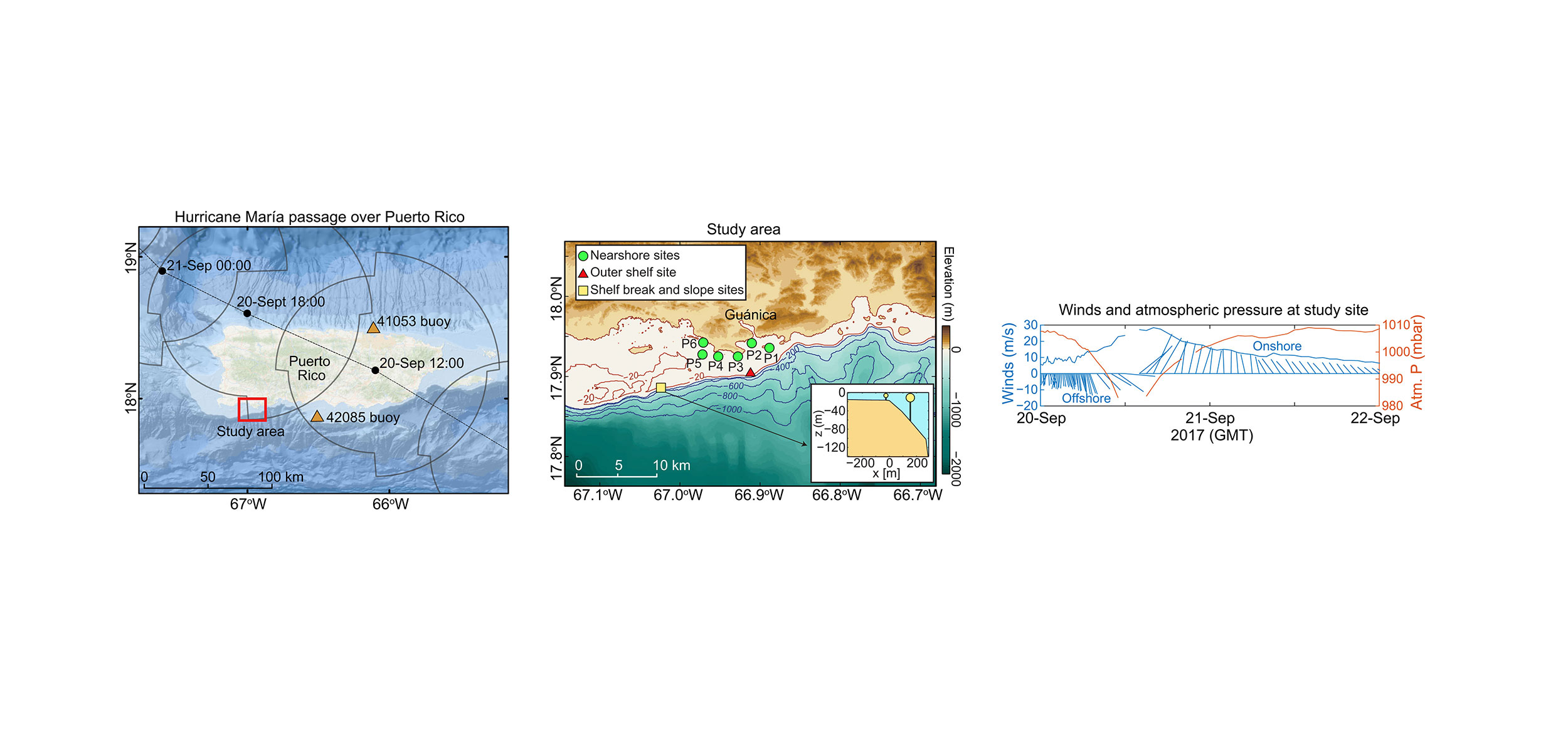
(Left) Map of Puerto Rico showing study area location (red box), the oceanographic buoys (orange triangles), and the track of María with eye timing and locations (black dots) in 6-hour increments and the wind radii of 64-knot winds (gray circular outlines).
(Middle) Study area showing location of nearshore shelf instrument packages (P1 to P6), the outer shelf wave and current meter (red triangle), as well as the shelf break mooring and the upper slope mooring and current meter (yellow square). Inset box shows approximate bathymetric profile of upper slope and across-shore location of shelf break and slope sites according to distance offshore of the shelf break.
(Right) Wind velocity (blue) and atmospheric pressure (orange) measured at buoy 42085 during hurricane passage. Stick vector directions point in “direction toward.”
Sources/Usage
Public Domain.
Rapid observations of ocean dynamics and stratification along a steep island coast during Hurricane María
by Cheriton, O.; Storlazzi, C.; Rosenberger, K.J.; Sherman, C.E; and Schmidt, W., 2021, Science Advances Vol. 7, no. 20, eabf1552, DOI: 10.1126/sciadv.abf1552