
Rangeland Map 2
Detailed Description
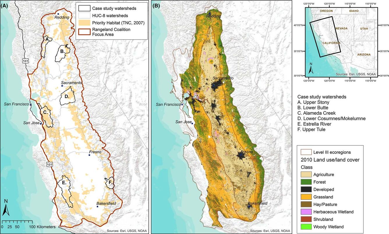
A) California Rangeland Conservation Coalition focus area, HUC-8 watershed boundaries clipped to focus area boundary, six case study watersheds, and priority habitat mapped by The Nature Conservancy (2007);
B) baseline 2010 land use–land cover (LULC) following the modified National Landcover Dataset classification for two level III EPA ecoregions: California Central Valley and Chaparral and Oak Woodlands. Priority habitat is defined as rangeland habitat in unprotected critical priority conservation areas mapped in the Rangeland Coalition focus area map (The Nature Conservancy 2007). LULC in the ecoregions was used to represent LULC for the focus area.
Sources/Usage
Public Domain.