
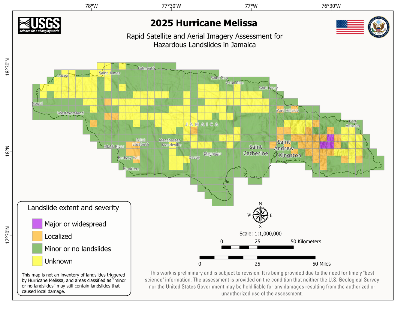
Rapid imagery assessment for hazardous landslides in Jamaica following 2025 Hurricane Melissa
Detailed Description
Map of Jamaica showing areas analyzed for landslides following 2025 Hurricane Melissa using aerial and satellite imagery. Colors indicate where landslides occurred and how severe they were.
Sources/Usage
Public Domain.
Related
2025 Hurricane Melissa Landslide Hazards
Hurricane Melissa, a category 5 storm, made landfall on October 28, 2025, near the border of Westmoreland and St. Elizabeth Parishes, southwestern Jamaica. The storm brought heavy rainfall, strong winds, and flooding to much of the Caribbean. In Jamaica, intense rainfall on steep mountainous terrain raised concern about potential landslides. This landslide event page serves as an event summary to...