
Repeat photography of a beach in Grand Canyon
By Southwest Biological Science Center
2013 (approx.)
Detailed Description
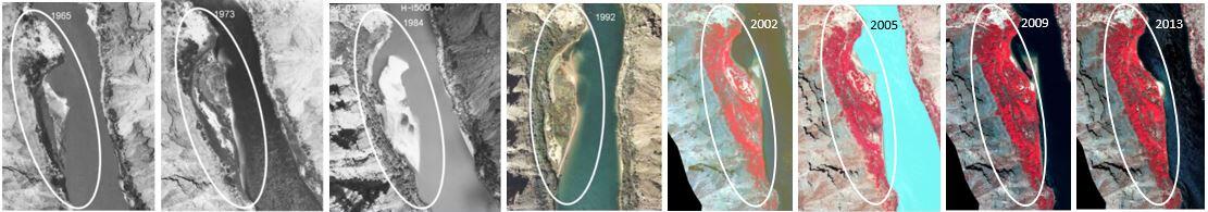
Repeat aerial imagery allows SBSC scientist to track natural resources over time. This series is from Kwagunt Marsh, 66 river miles (106 km) downstream of Glen Cayon Dam, show vegetation cover from 1963 to 2013.
Sources/Usage
Public Domain.