
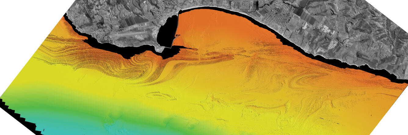
Rotated version of the multibeam bathymetry map off Half Moon Bay, CA
By Pacific Coastal and Marine Science Center
2014 (approx.)
Detailed Description
Map view. Colored shaded-relief bathymetry map of Offshore of Half Moon Bay map area, generated from multibeam echosounder data. Colors show depth: reds and oranges indicate shallower areas; light blues, deeper areas. Illumination azimuth is 300°, from 45° above horizon.
Sources/Usage
Public Domain.