
Sample sites used in black particles from road tire wear study
Detailed Description
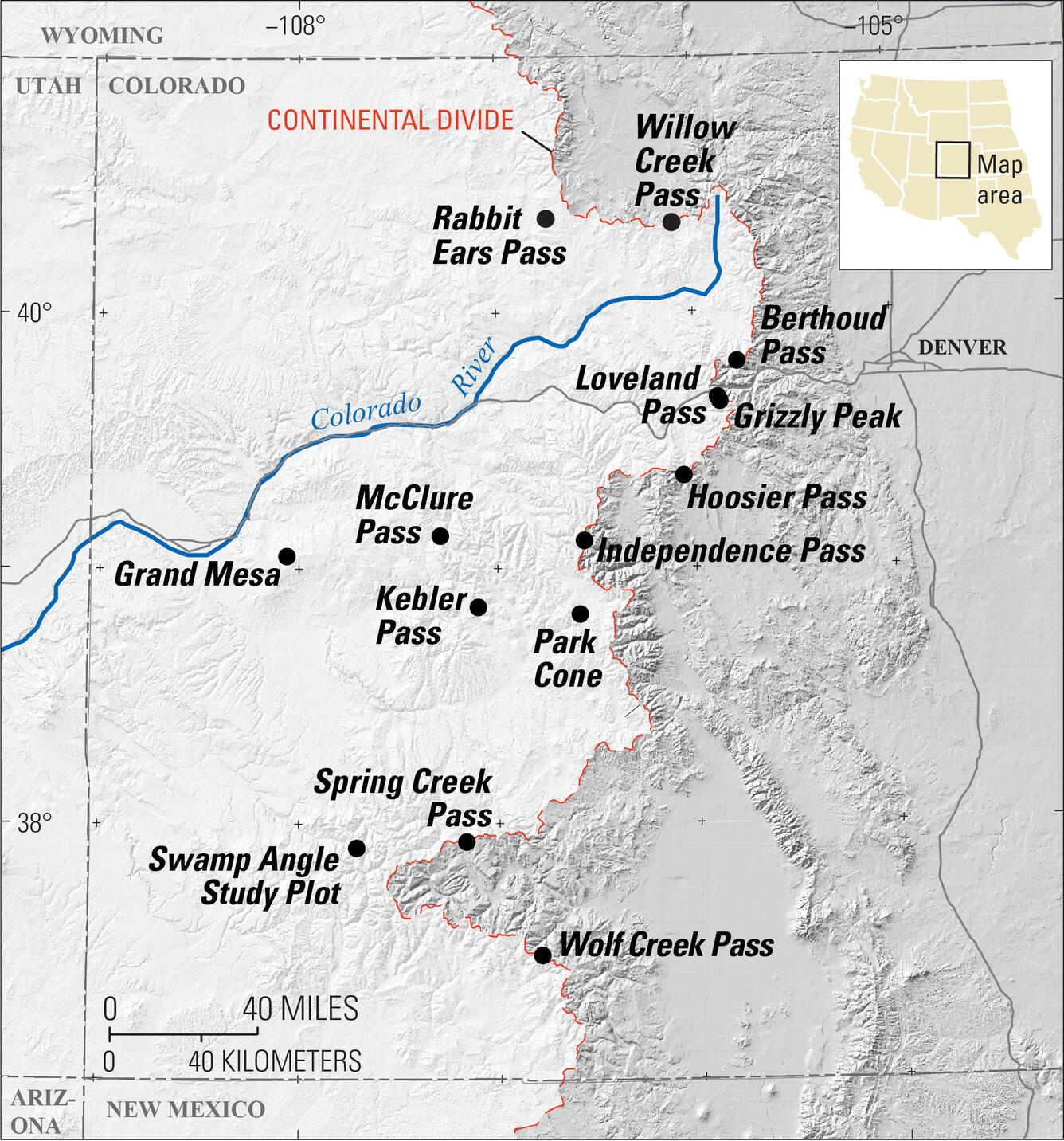
Map showing locations of snow sampling sites (black circles) within the Upper Colorado River basin, the Colorado River, and the Continental Divide. The locations are Berthoud Pass, Grand Mesa, Grizzly Peak, Hoosier Pass, Independence Pass, Kebler Pass, Loveland Pass, McClure Pass, Park Cone, Rabbit Ears Pass, Swamp Angle Study Plot, Spring Creek Pass, Willow Creek Pass, Wolf Creek Pass. Shaded relief created from the National Elevation Dataset.
Sources/Usage
Public Domain.
Related

Where the Rubber Meets the Road and Ends Up in Snow: The Hidden Effects of Tire Matter on Snowmelt and Mountain Ecosystems
Black particles from road tire wear may be an important component to the melting of snow and ice and the warming atmosphere.
Related
Where the Rubber Meets the Road and Ends Up in Snow: The Hidden Effects of Tire Matter on Snowmelt and Mountain Ecosystems
Black particles from road tire wear may be an important component to the melting of snow and ice and the warming atmosphere.