
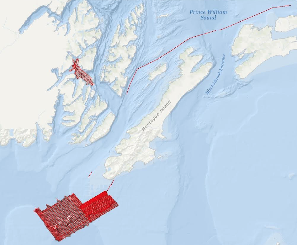
Seismic lines and bathymetry grids collected offshore of Alaska
Detailed Description
High-resolution acoustic backscatter data, bathymetry data, single channel minisparker seismic-reflection data were collected by the USGS and the Alaska Department of Fish and Game in May of 2014 southwest of Chenega Island and southwest of Montague Island, Alaska.
Sources/Usage
Public Domain.
Bathymetry, acoustic backscatter, and minisparker seismic-reflection datasets collected southwest of Montague Island and Chenega
Balster-Gee, A.F., Brothers, D.S., Finlayson, D.P., Liberty, L., Dartnell, P., Hatcher, G.A., Haeussler, P.J., and Byerly, M., 2019, Bathymetry, acoustic backscatter, and minisparker seismic-reflection datasets collected southwest of Montague Island and southwest of Chenega, Alaska during field activity 2014-622-FA: U.S. Geological Survey data release, doi: 10.5066/P9K1YQ35