
USGS Gage At Covered Bridge

Detailed Description
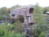
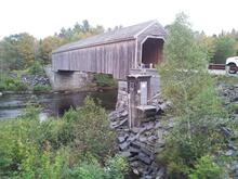
This photograph shows Lowe's Bridge off ME-15 in Guilford, Maine, spanning the Piscataquis River. USGS gaging station 01031500 is located on the downstream side of the bridge. The original bridge, built in 1857, washed away in the flood of 1987, and was rebuilt on the original abutments in 1990.
Sources/Usage
Public Domain.